les adrets de l'esterel
Cities and villages

Les Adrets de l'Estérel

A stone's throw from Saint-Raphaël, Les Adrets de l'Esterel is a town located in the extreme southeast of the Var. Bordering the Maritime Alps, its territory is composed of large green forests. The town overlooks the bay of Cannes and has an exceptional view of the Lerins islands and la Corniche de l'Estérel.

Between the Esterel massif and the Mediterranean...

Covering an area of 22km², the town is located at an altitude of 250 meters above sea level and has a magnificent view of the bay of Cannes and the Islands of Lerins.

At the beginning, "Les Adrets" was only a hamlet of Montauroux, called "Les Maures de Montauroux". The term "Moors" referred to uncultivated land intended for grazing. Due to the distance of the village from Montauroux, Napoleon III decided to make it a commune in April 1867, under the name "Les Adrets de Montauroux". All the villages and hamlets called "Adrets" have as their etymology a Latin verb meaning "to be burned". These are generally high places exposed to the sun (whereas "hubacs" are low places located on the northern slope of a mountain). In Provençal, "Adré" or "Adrech" means "good side".

In the heart of the massif, many excursions and hikes start from the city: Mont Vinaigre, Esterel massif, Avellan lake, the small valley of the Verrerie, la Beïlesse...


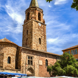
A little bit of history

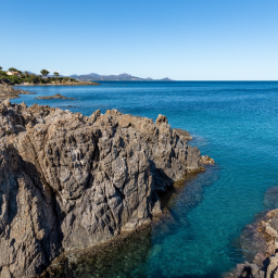
At the time, cork lifting was very important in the town of Adrets because it has many oaks in its national forest. Throughout the summer, the old breeders lived in the woods and were supplied every week. Traditionally, no one brought personal cutlery and everyone carved their own bowls and plates directly from the natural bumps of the oaks. Today, lifting is still carried out, but to a lesser extent, in order to "rest" many oak trees threatened by insects and diseases. More information

Near the town, the Fontsante mines were once operated, in addition to those of Maurevieille near Théoule-sur-Mer. This deposit, discovered following a fire, had more than 24 ore veins, some of which exceeded 500 metres. Most of it was exported to the United States. The extracted fluorite was used as a flux in the processing of steel and aluminum. More information

Nowadays, the town often honours traditional trades such as coalmining, art binding, hat trade... The Festival de l'Esterel, which takes place in July, highlights these trades, tools and materials of yesteryear.

RN7: History of the holiday road

Historically, the Romans settled and built roads, which were called "Roman roads". Here, the "Voie Aurélienne" crosses the Esterel massif. It linked the region to Rome. This road followed the route of the old National 7 from Mandelieu to the Adrets de l'Esterel. The history of the RN7 began in Puget-sur-Argens in 1957.The section went as far as Mandelieu-la-Napoule. It was the largest road construction site in France, with more than 50 km of road created and millions of m³ of rubble extracted. The motorway was completed in 1962 with the inauguration of the second section to Villeneuve-Loubet. Today, the historic Route Nationale 7 to Mandelieu has more than 183 turns. Before the construction work began, the route had very few dwellings, except the Auberge des Adrets. This former post office was the favorite territory of the bandit Gaspard de Besse. His main targets were wealthy travelers and tax collectors.

Gaspard de Besse and the Auberge des Adrets

The Massif de l'Esterel, today known for its recreational escapades, was once the haunt of many bandits. The most famous of them was Gaspard de Besse. He chose to become a thief despite having been educated by a priest. He took refuge in the Esterel with his band. Often compared to Robin Hood for his generous actions towards the little people, they plunder, steal, and ransom travelers, but never kill. His motto: "Scare but never kill". It is in the Auberge des Adrets that he sets up his headquarters and his thirty henchmen. The old post house was abandoned when the railway arrived around 1865. Gaspard de Besse was arrested in 1781 in an auberge located in La Valette du Var. A few weeks later, he was tortured on the wheel in the Grand Place of Aix-en-Provence. Some say that he didn't die on the wheel and that he ended his career as a colonel of the Empire. Two films have been made about his story. The first one by André Hugon in 1935 with Raimu, based on the work of Jean Aicard and the second, a TV film by Benoît Jacquot in 2007, with Jean-Hugues Anglade.

Instagram : Share your pictures #Visitesterel !

Post your most beautiful pictures with the hashtag #VisitEsterel and follow the account @esterelcotedazur to be reposted !

Estérel Côte d'Azur depending on your mood
Weather
Sea side
Today
-- °C Wind : -- km/h
Tomorrow
-- °C Wind : -- km/h
After tomorrow
-- °C Wind : -- km/h
Hinterland
Today
-- °C Wind : -- km/h
Tomorrow
-- °C Wind : -- km/h
After tomorrow
-- °C Wind : -- km/h
Water temperature
Fréjus -- °C
Saint-Raphaël -- °C
Les Issambres -- °C
+
-

Clic on areas to zoom in

Clear map
Dark map
Map zone 1
Map zone 2
Map zone 3
Map zone 4
Map zone 5
Map zone 7
Map zone 6
Map zone 8
pays de fayence - nord

Fayence area

The Pays de Fayence (Fayence district) has many great provencal villages. All of them have a particularity such as the view from Mons or the artistic streets of Tourrettes. Do no forget to stop in Seillans that has the label of "Most beautiful village in France"

Go back to map
pays de fayence - sud

Fayence area

North of the A8 motorway, you will find the Pays de Fayence. Saint-Cassien lake, a real oasis of freshness in the Var, awaits you! Take a break at the Lake House before visiting the villages of Bagnols-en-Forêt, St-Paul-en-Forêt or Tanneron.

Go back to map
roquebrune sur argens - la bouverie

Roquebrune-sur-Argens

The city of Roquebrune-sur-Argens is the most westerly of the destination. It includes three districts: La Bouverie, at the foot of Gorges du Blavet; The village, overlooked by its magnificent rock, and Les Issambres, with its nautical activities by the sea.

Go back to map
les adrets de l'esterel

Les Adrets de l'Estérel

Les Adrets de l'Estérel is a small town located at the extreme southeastern Var. Bordering the Maritimes Alpes, it is composed of large green forests. The town overlooks the bay of Cannes and has an exceptional view on the Lérins Islands and the Corniche de l'Estérel.

Go back to map
village de puget sur argens

Puget sur Argens

Puget sur Argens is a small village located in the middle of many wineries. Its commercial area, near the village, includes many shopping center. North of the village, the Bois du Defens give rise to several walks.

Go back to map
roquebrune-sur-argens - les issambres

Les Issambres

Welcome to Les Issambres, the district of Roquebrune-sur-Argens located on the coast. True paradise with its 8 km of beaches and creeks, this family seaside resort, already frequented at the time by the Romans, is located between the Gulf of Saint-Tropez and Fréjus-Saint Raphaël.

Go back to map
ville de frejus - saint-aygulf

Fréjus

Frejus, located halfway between Cannes and Saint-Tropez, is at the heart of the Côte d'Azur. Based on a sandstone buttress of the Esterel massif, the town dominates the valleys of Argens and Reyran. Frejus has the appearance of a small Provencal town whose new districts extend to the sea.

Go back to map
saint-raphael - massif de l'esterel

Saint-Raphaël

65km from Nice Côte d'Azur International Airport, Saint-Raphaël is located between Cannes and Saint-Tropez. This seaside resort on the Mediterranean coast is at the bottom of the great Esterel mountains. Saint Raphael, whose city center is by the sea, is divided into different neighborhoods that have all their characteristics and their personalities.

Go back to map
Fayence areaFayence areaRoquebrune-sur-ArgensLes Adrets de l'EstérelPuget sur ArgensLes IssambresFréjusSaint-Raphaël
Webcams
Subscribe to our newsletter