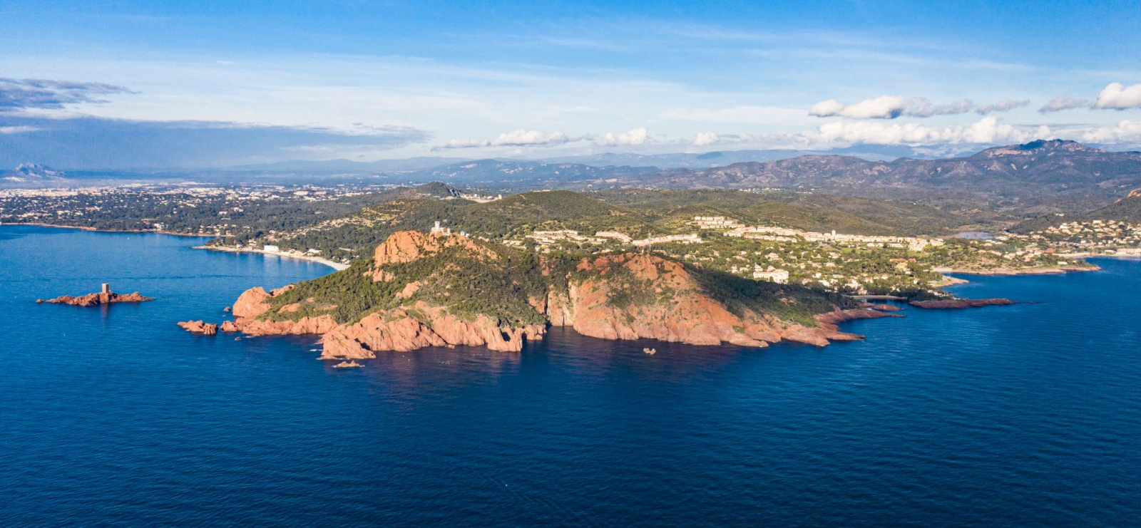
Randonnée Cap Dramont
Estérel Côte d'Azur
Pedestrian sports, Hiking itinerary

Hiking at Cap Dramont

Come to the famous Cap Dramont for a colourful walk between the emerald-blue of the Mediterranean Sea and the red-tinged rocks of the massif.
Tip: don't forget your camera!

Description

> ACCESS
- By car from Agay: take the seaside road (towards Agay) as far as Dramont. Turn right at the "Tiki plage" sign and park in the car park at the end of allée Robinson.
- By bus: Line 8, Camp Long stop
Continue along the road to the Tiki plage sign, turn right onto allée Robinson and head up to the car park.
- By train: TER 3
Stop: le Dramont

> STARTING POINT
GPS coordinates: 43.419851, 6.857629
Camp Long beach

> ROUTE
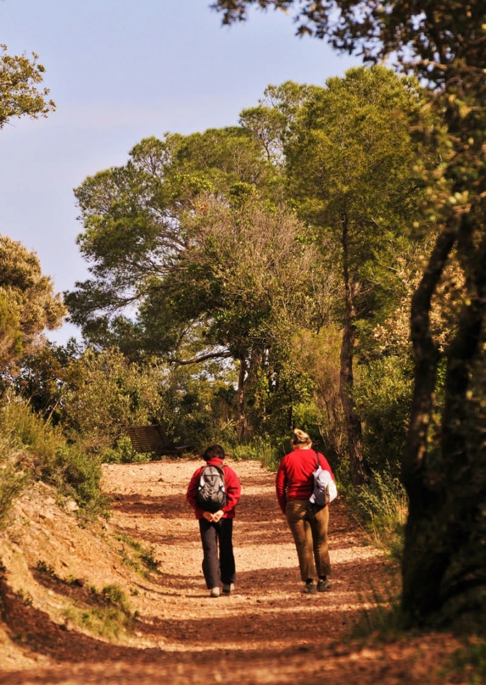
Take the small yellow signposted path along the seafront. This follows the contours of the rock, arriving at an overhang.

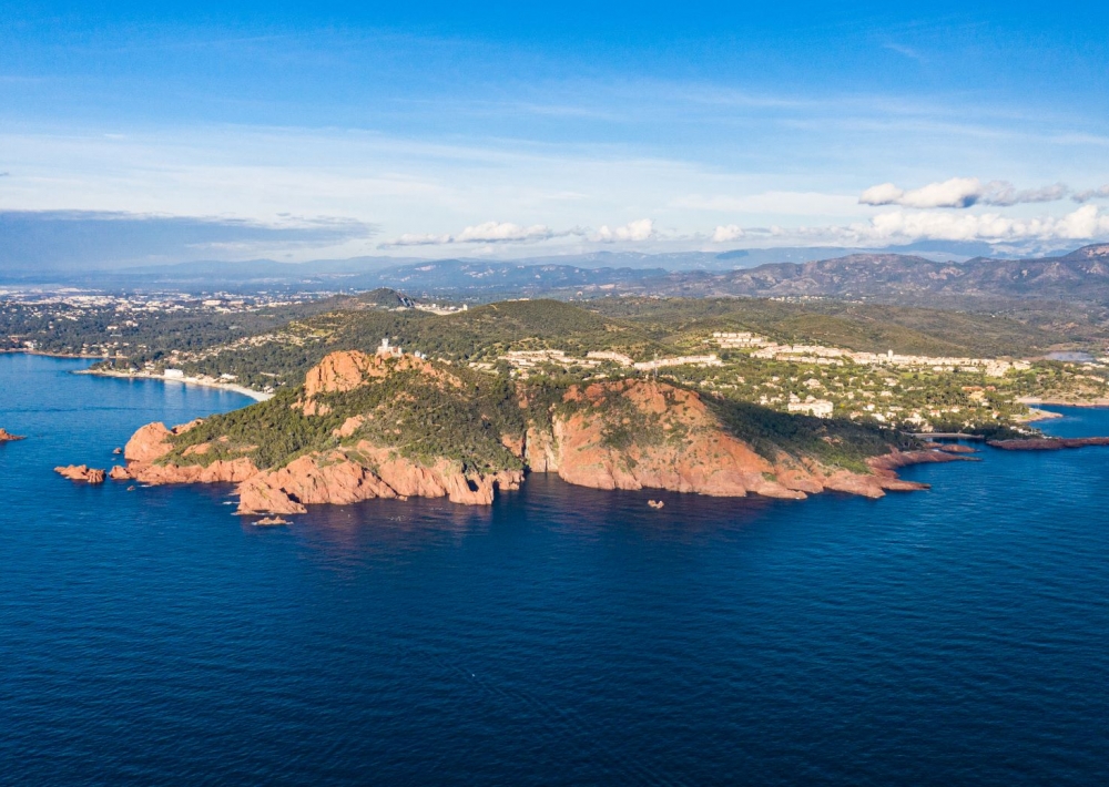
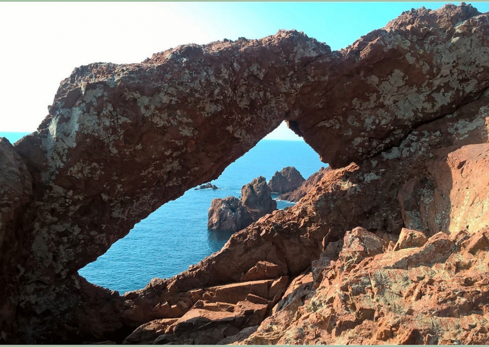
Continue right up the narrowing path. At the top, branch off to the left. The path then follows the top of the cliff with breathtaking views.

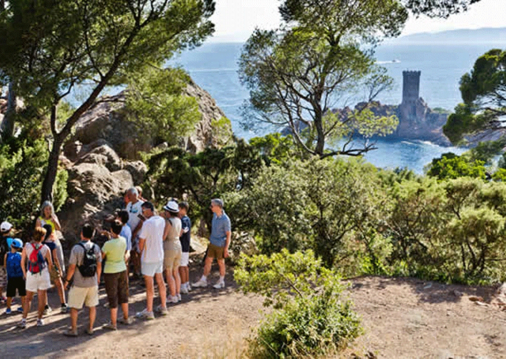
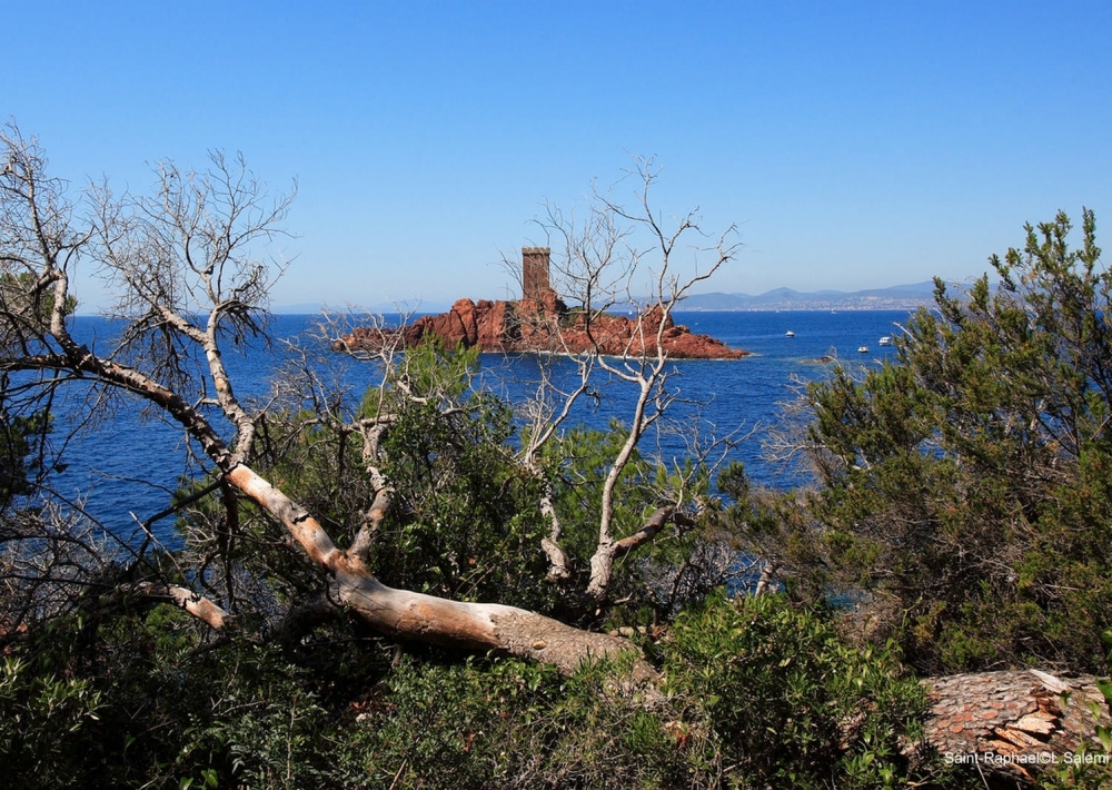
At the next junction, turn right onto a path that climbs up and joins the tarmac track. Climb up to the Semaphore (go around it to the right) to discover breathtaking views.

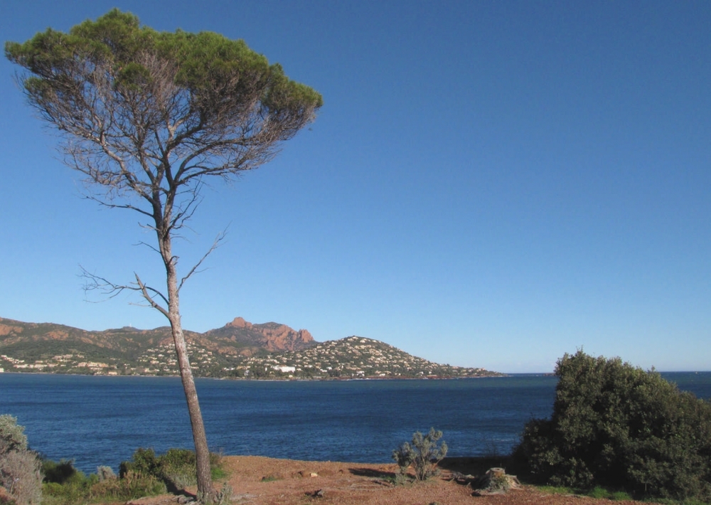
Descend at the junction and continue right along the tarmac track overlooking the southern slopes of Cap Dramont.

At the end of the track, before turning right onto the path that will take you back to the starting point, make a diversion to the left as far as Port du Poussaï, a typical, colourful little port.

Further information

  • flag-FRFrench
  • Type of customers : 
    Level green – easy
  • On-site activities : 
    Pedestrian sports
    Hiking itinerary
  • Environments : 
    Sea view
    Panoramic view
    Coastal
Estérel Côte d'Azur depending on your mood
Weather
Sea side
Today
-- °C Wind : -- km/h
Tomorrow
-- °C Wind : -- km/h
After tomorrow
-- °C Wind : -- km/h
Hinterland
Today
-- °C Wind : -- km/h
Tomorrow
-- °C Wind : -- km/h
After tomorrow
-- °C Wind : -- km/h
Water temperature
Fréjus -- °C
Saint-Raphaël -- °C
Les Issambres -- °C
+
-

Clic on areas to zoom in

Clear map
Dark map
Map zone 1
Map zone 2
Map zone 3
Map zone 4
Map zone 5
Map zone 7
Map zone 6
Map zone 8
pays de fayence - nord

Fayence area

The Pays de Fayence (Fayence district) has many great provencal villages. All of them have a particularity such as the view from Mons or the artistic streets of Tourrettes. Do no forget to stop in Seillans that has the label of "Most beautiful village in France"

Go back to map
pays de fayence - sud

Fayence area

North of the A8 motorway, you will find the Pays de Fayence. Saint-Cassien lake, a real oasis of freshness in the Var, awaits you! Take a break at the Lake House before visiting the villages of Bagnols-en-Forêt, St-Paul-en-Forêt or Tanneron.

Go back to map
roquebrune sur argens - la bouverie

Roquebrune-sur-Argens

The city of Roquebrune-sur-Argens is the most westerly of the destination. It includes three districts: La Bouverie, at the foot of Gorges du Blavet; The village, overlooked by its magnificent rock, and Les Issambres, with its nautical activities by the sea.

Go back to map
les adrets de l'esterel

Les Adrets de l'Estérel

Les Adrets de l'Estérel is a small town located at the extreme southeastern Var. Bordering the Maritimes Alpes, it is composed of large green forests. The town overlooks the bay of Cannes and has an exceptional view on the Lérins Islands and the Corniche de l'Estérel.

Go back to map
village de puget sur argens

Puget sur Argens

Puget sur Argens is a small village located in the middle of many wineries. Its commercial area, near the village, includes many shopping center. North of the village, the Bois du Defens give rise to several walks.

Go back to map
roquebrune-sur-argens - les issambres

Les Issambres

Welcome to Les Issambres, the district of Roquebrune-sur-Argens located on the coast. True paradise with its 8 km of beaches and creeks, this family seaside resort, already frequented at the time by the Romans, is located between the Gulf of Saint-Tropez and Fréjus-Saint Raphaël.

Go back to map
ville de frejus - saint-aygulf

Fréjus

Frejus, located halfway between Cannes and Saint-Tropez, is at the heart of the Côte d'Azur. Based on a sandstone buttress of the Esterel massif, the town dominates the valleys of Argens and Reyran. Frejus has the appearance of a small Provencal town whose new districts extend to the sea.

Go back to map
saint-raphael - massif de l'esterel

Saint-Raphaël

65km from Nice Côte d'Azur International Airport, Saint-Raphaël is located between Cannes and Saint-Tropez. This seaside resort on the Mediterranean coast is at the bottom of the great Esterel mountains. Saint Raphael, whose city center is by the sea, is divided into different neighborhoods that have all their characteristics and their personalities.

Go back to map
Fayence areaFayence areaRoquebrune-sur-ArgensLes Adrets de l'EstérelPuget sur ArgensLes IssambresFréjusSaint-Raphaël
Webcams
Subscribe to our newsletter