Étang d'Aubert
©Asso REV
Pedestrian sports, Hiking itinerary

Hiking at Aubert lake

An easy hike among red rocks and pine trees in the heart of the massif. This partly-shaded itinerary is very pleasant in summer, with places to relax on the banks of Aubert lake.

Description

> ACCESS
Follow the seafront in the direction of Agay. At the Agay roundabout, follow the signs for "Massif de l'Estérel", pass under the small railway bridge, go past the industrial estate and, immediately afterwards, turn right onto the small road signposted "Massif de l'Estérel". Then follow the signs for the Col de Belle Barbe. Your destination will be on your right.

> STARTING POINT
You can park at the Col de Belle Barbe car park and the departure point is located there.

> ITINERARY
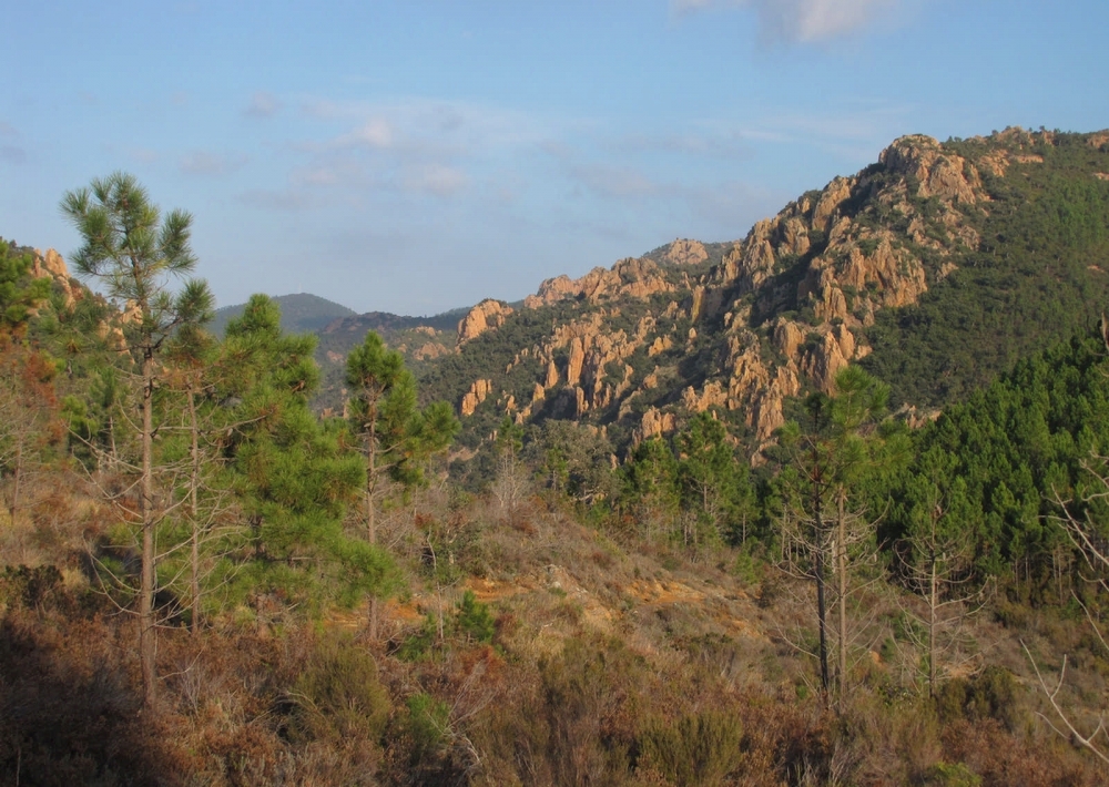
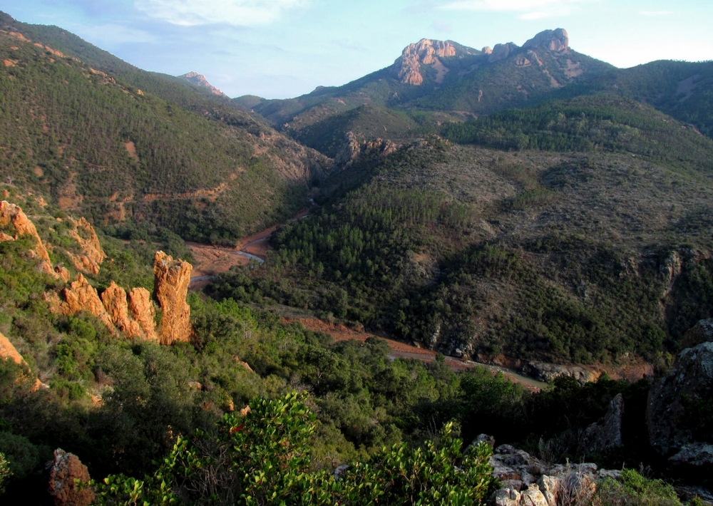
From the Col de Belle Barbe, follow the blue signposted path. 50 m after the start, turn right (leaving the return path on your left). The path first overhangs the Malinfernet stream, then passes through a pine forest before reaching a new junction. To the left is the way back, but keep straight on for now. Follow the path to discover the magnificent view of the jagged rocks of Le Perthus.
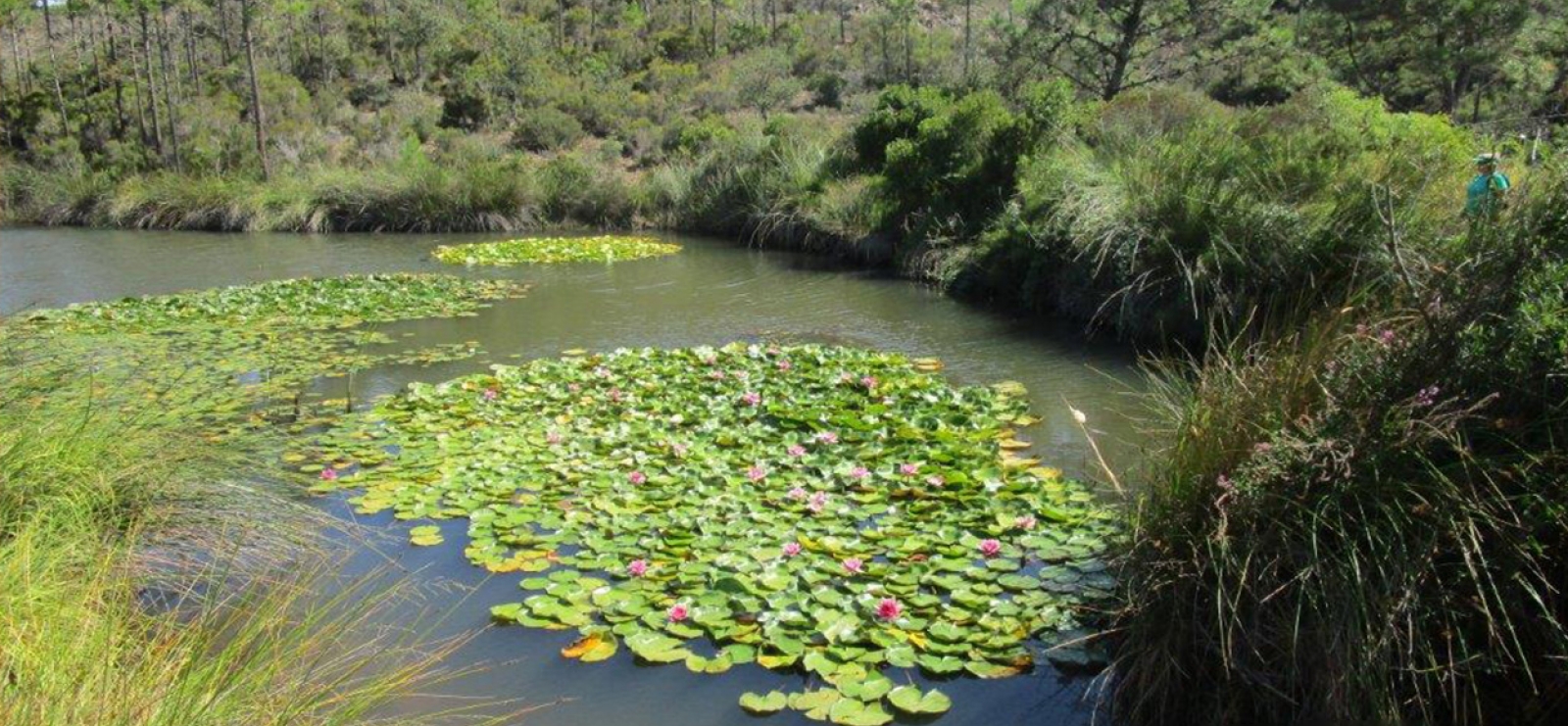
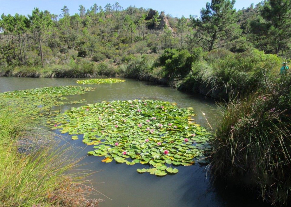
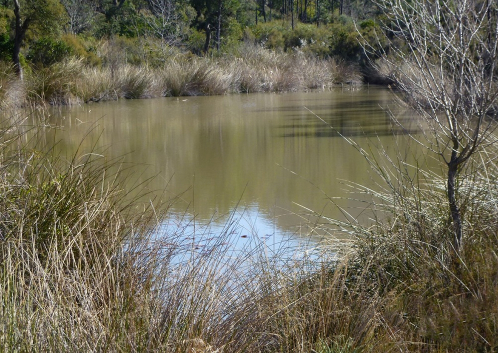
You then arrive at the Col d'Aubert where several paths meet. Turn left down the path. 500 m further on, you reach the small Aubert Pond, an ideal spot for a picnic break. The pond, fed by rainwater running off the Baladou, offers walkers its water lilies, in bloom in summer.
Retrace your steps and climb back up to the Col d'Aubert. From here, turn right along the path you took on the way to the crossroads. The path takes you back down through the trees to the Col de Belle Barbe.

> Warning! Be prepared: in summer, when the weather is hot and the Mistral is blowing, the Massif may be closed due to the risk of fire. Consult the "practical information" page for daily updates.

Further information

  • flag-FRFrench
  • Type of customers : 
    Level bue - Medium
  • On-site activities : 
    Pedestrian sports
    Hiking itinerary
  • Environments : 
    Forest location
    Lake view
    Mountain location
Estérel Côte d'Azur depending on your mood
Weather
Sea side
Today
-- °C Wind : -- km/h
Tomorrow
-- °C Wind : -- km/h
After tomorrow
-- °C Wind : -- km/h
Hinterland
Today
-- °C Wind : -- km/h
Tomorrow
-- °C Wind : -- km/h
After tomorrow
-- °C Wind : -- km/h
Water temperature
Fréjus -- °C
Saint-Raphaël -- °C
Les Issambres -- °C
+
-

Clic on areas to zoom in

Clear map
Dark map
Map zone 1
Map zone 2
Map zone 3
Map zone 4
Map zone 5
Map zone 7
Map zone 6
Map zone 8
pays de fayence - nord

Fayence area

The Pays de Fayence (Fayence district) has many great provencal villages. All of them have a particularity such as the view from Mons or the artistic streets of Tourrettes. Do no forget to stop in Seillans that has the label of "Most beautiful village in France"

Go back to map
pays de fayence - sud

Fayence area

North of the A8 motorway, you will find the Pays de Fayence. Saint-Cassien lake, a real oasis of freshness in the Var, awaits you! Take a break at the Lake House before visiting the villages of Bagnols-en-Forêt, St-Paul-en-Forêt or Tanneron.

Go back to map
roquebrune sur argens - la bouverie

Roquebrune-sur-Argens

The city of Roquebrune-sur-Argens is the most westerly of the destination. It includes three districts: La Bouverie, at the foot of Gorges du Blavet; The village, overlooked by its magnificent rock, and Les Issambres, with its nautical activities by the sea.

Go back to map
les adrets de l'esterel

Les Adrets de l'Estérel

Les Adrets de l'Estérel is a small town located at the extreme southeastern Var. Bordering the Maritimes Alpes, it is composed of large green forests. The town overlooks the bay of Cannes and has an exceptional view on the Lérins Islands and the Corniche de l'Estérel.

Go back to map
village de puget sur argens

Puget sur Argens

Puget sur Argens is a small village located in the middle of many wineries. Its commercial area, near the village, includes many shopping center. North of the village, the Bois du Defens give rise to several walks.

Go back to map
roquebrune-sur-argens - les issambres

Les Issambres

Welcome to Les Issambres, the district of Roquebrune-sur-Argens located on the coast. True paradise with its 8 km of beaches and creeks, this family seaside resort, already frequented at the time by the Romans, is located between the Gulf of Saint-Tropez and Fréjus-Saint Raphaël.

Go back to map
ville de frejus - saint-aygulf

Fréjus

Frejus, located halfway between Cannes and Saint-Tropez, is at the heart of the Côte d'Azur. Based on a sandstone buttress of the Esterel massif, the town dominates the valleys of Argens and Reyran. Frejus has the appearance of a small Provencal town whose new districts extend to the sea.

Go back to map
saint-raphael - massif de l'esterel

Saint-Raphaël

65km from Nice Côte d'Azur International Airport, Saint-Raphaël is located between Cannes and Saint-Tropez. This seaside resort on the Mediterranean coast is at the bottom of the great Esterel mountains. Saint Raphael, whose city center is by the sea, is divided into different neighborhoods that have all their characteristics and their personalities.

Go back to map
Fayence areaFayence areaRoquebrune-sur-ArgensLes Adrets de l'EstérelPuget sur ArgensLes IssambresFréjusSaint-Raphaël
Webcams
Subscribe to our newsletter