Sentier des meules
Estérel Côte d'Azur
Pedestrian sports, Hiking itinerary

Randonnée : Sentier des Meulières

An emblematic family hike that allows you to discover both the local flora and the historical heritage of Puget sur Argens. During this hike, you'll discover an old millstone quarry on an exceptional site.

Description

> ACCÈS
Depuis Puget sur Argens, prendre le boulevard Général Leclerc jusqu'au domaine de la Lieutenante.
Parking aménagé juste en face de l'entrée du Domaine de La Lieutenante.

> POINT DE DÉPART
Coordonnées GPS : 43.496599, 6.696332
Aire Guy Manganelli

> ITINÉRAIRE
Emprunter la piste des Lauriers jusqu’à la première intersection. Quitter la piste en prenant à gauche et suivre le chemin sur environ 700 m.

Le repère suivant est dans une courbe, distinguer alors le départ d’un sentier sur votre droite avec des ruches. Juste au-dessus, prendre le sentier escarpé sur la
gauche, qui monte vers la partie la plus boisée du parcours. Ce petit chemin escarpé présente un dénivelé d’une centaine de mètres avant d’arriver au
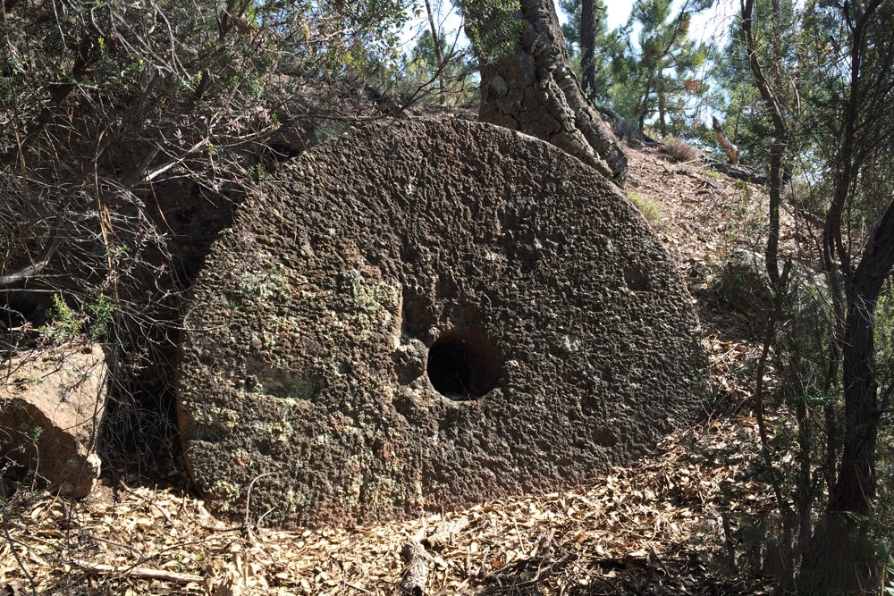
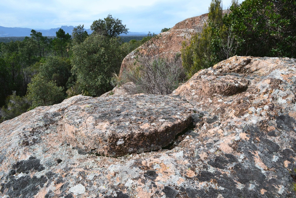
premier site de meules qui sera sur votre gauche. Un amas de pierres signale l’entrée de ce dernier.

Continuer ensuite le chemin jusqu’à rejoindre la piste principale puis continuer
tout droit comme indiqué sur le tracé.

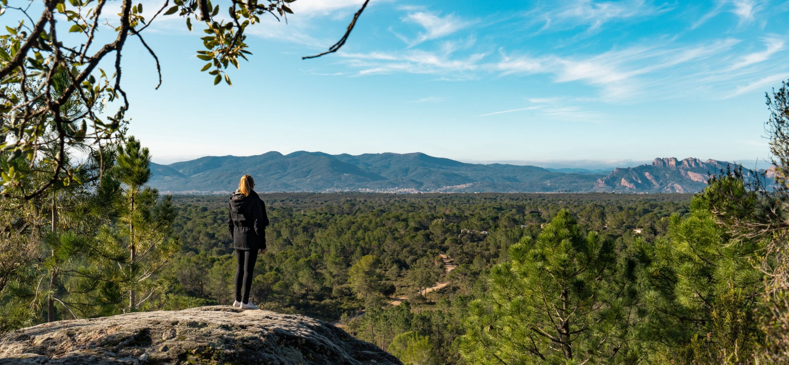
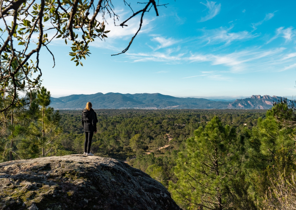
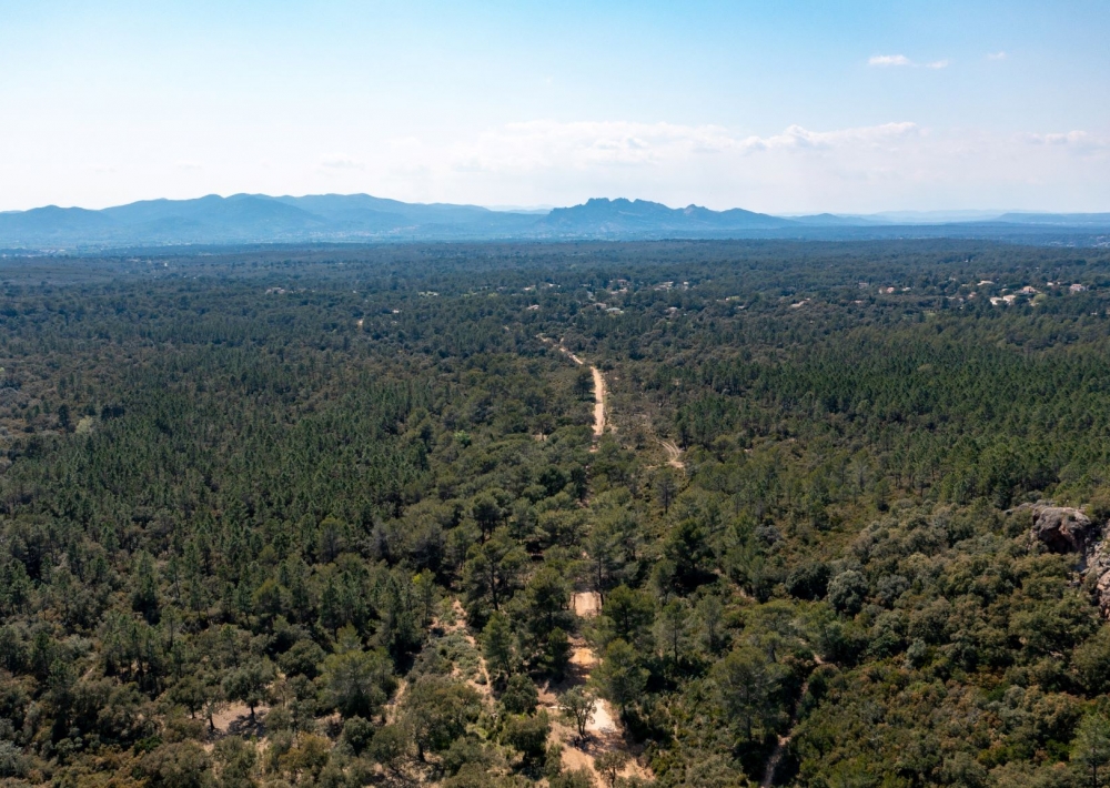
Le deuxième site d’extraction offre un beau point de vue notamment sur le Rocher de Roquebrune et le Mont Vinaigre à l’Est.

À l’intersection, prendre à droite pour reprendre la piste des Lauriers qui vous
ramènera jusqu’à votre point de départ.

Further information

  • Accepted animals
  • flag-FRFrench
  • Type of customers : 
    Level green – easy
  • Services : 
    Pets welcome
  • Equipments : 
    Picnic area
  • On-site activities : 
    Pedestrian sports
    Hiking itinerary
  • Environments : 
    Forest location
    Panoramic view
Estérel Côte d'Azur depending on your mood
Weather
Sea side
Today
-- °C Wind : -- km/h
Tomorrow
-- °C Wind : -- km/h
After tomorrow
-- °C Wind : -- km/h
Hinterland
Today
-- °C Wind : -- km/h
Tomorrow
-- °C Wind : -- km/h
After tomorrow
-- °C Wind : -- km/h
Water temperature
Fréjus -- °C
Saint-Raphaël -- °C
Les Issambres -- °C
+
-

Clic on areas to zoom in

Clear map
Dark map
Map zone 1
Map zone 2
Map zone 3
Map zone 4
Map zone 5
Map zone 7
Map zone 6
Map zone 8
pays de fayence - nord

Fayence area

The Pays de Fayence (Fayence district) has many great provencal villages. All of them have a particularity such as the view from Mons or the artistic streets of Tourrettes. Do no forget to stop in Seillans that has the label of "Most beautiful village in France"

Go back to map
pays de fayence - sud

Fayence area

North of the A8 motorway, you will find the Pays de Fayence. Saint-Cassien lake, a real oasis of freshness in the Var, awaits you! Take a break at the Lake House before visiting the villages of Bagnols-en-Forêt, St-Paul-en-Forêt or Tanneron.

Go back to map
roquebrune sur argens - la bouverie

Roquebrune-sur-Argens

The city of Roquebrune-sur-Argens is the most westerly of the destination. It includes three districts: La Bouverie, at the foot of Gorges du Blavet; The village, overlooked by its magnificent rock, and Les Issambres, with its nautical activities by the sea.

Go back to map
les adrets de l'esterel

Les Adrets de l'Estérel

Les Adrets de l'Estérel is a small town located at the extreme southeastern Var. Bordering the Maritimes Alpes, it is composed of large green forests. The town overlooks the bay of Cannes and has an exceptional view on the Lérins Islands and the Corniche de l'Estérel.

Go back to map
village de puget sur argens

Puget sur Argens

Puget sur Argens is a small village located in the middle of many wineries. Its commercial area, near the village, includes many shopping center. North of the village, the Bois du Defens give rise to several walks.

Go back to map
roquebrune-sur-argens - les issambres

Les Issambres

Welcome to Les Issambres, the district of Roquebrune-sur-Argens located on the coast. True paradise with its 8 km of beaches and creeks, this family seaside resort, already frequented at the time by the Romans, is located between the Gulf of Saint-Tropez and Fréjus-Saint Raphaël.

Go back to map
ville de frejus - saint-aygulf

Fréjus

Frejus, located halfway between Cannes and Saint-Tropez, is at the heart of the Côte d'Azur. Based on a sandstone buttress of the Esterel massif, the town dominates the valleys of Argens and Reyran. Frejus has the appearance of a small Provencal town whose new districts extend to the sea.

Go back to map
saint-raphael - massif de l'esterel

Saint-Raphaël

65km from Nice Côte d'Azur International Airport, Saint-Raphaël is located between Cannes and Saint-Tropez. This seaside resort on the Mediterranean coast is at the bottom of the great Esterel mountains. Saint Raphael, whose city center is by the sea, is divided into different neighborhoods that have all their characteristics and their personalities.

Go back to map
Fayence areaFayence areaRoquebrune-sur-ArgensLes Adrets de l'EstérelPuget sur ArgensLes IssambresFréjusSaint-Raphaël
Webcams
Subscribe to our newsletter