Blavet
DR/OT Roquebrune
Pedestrian sports, Hiking itinerary

Randonnée site du Blavet

In the green, steep gorges between La Bouverie and Bagnols-en-Forêt, with the red rocks of the Esterel massif in the background, these walks will fill you with color and intoxicate you with scents.

Description

Le site du Blavet est, à l’instar des sentiers du Rocher, connu depuis des centaines d’années. Au point du vue historique et patrimonial, la zone remonte à la Préhistoire mais a également été occupée de façon intense pendant la période romaine et jusqu’à la fin du Moyen-âge.
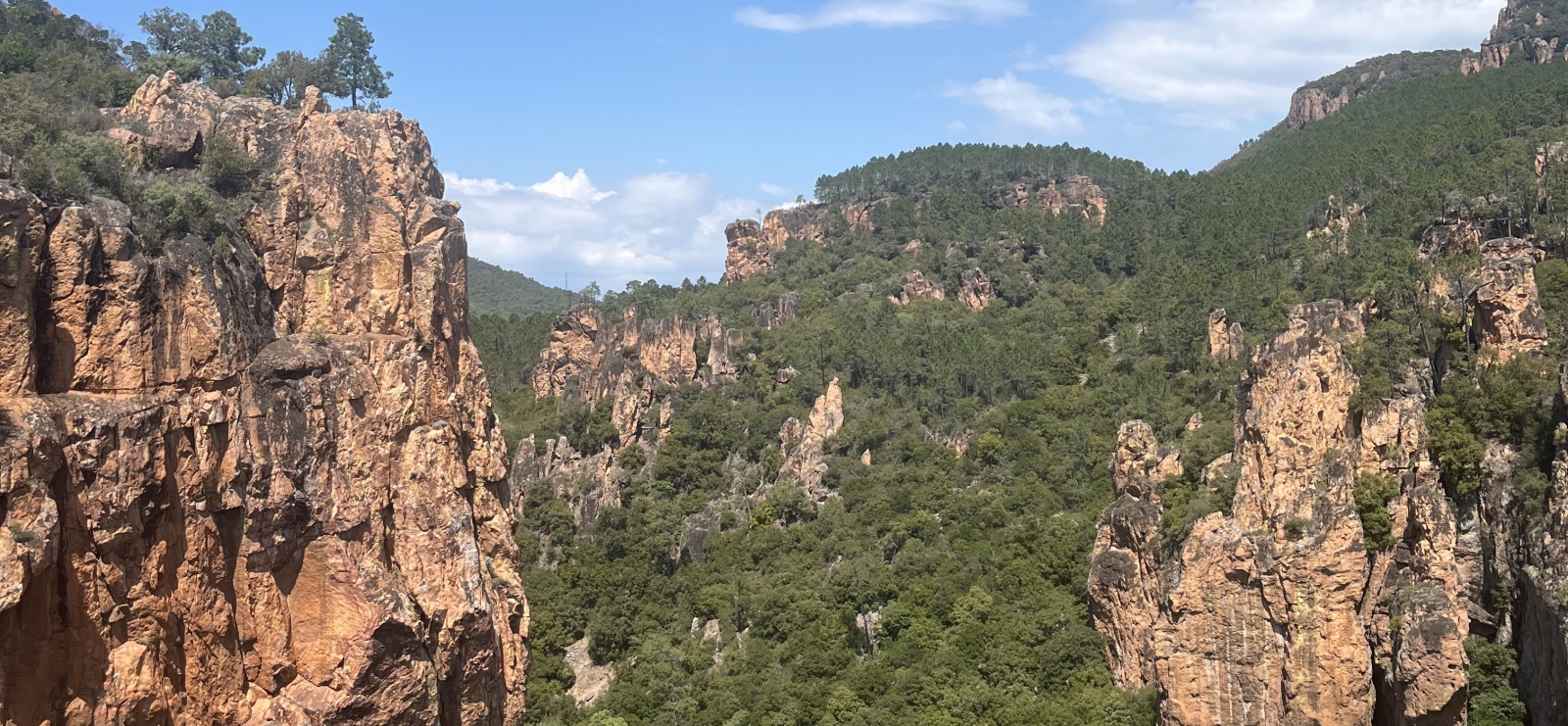
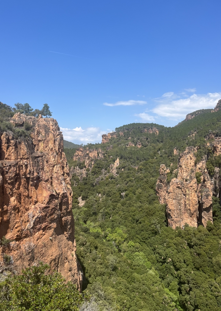
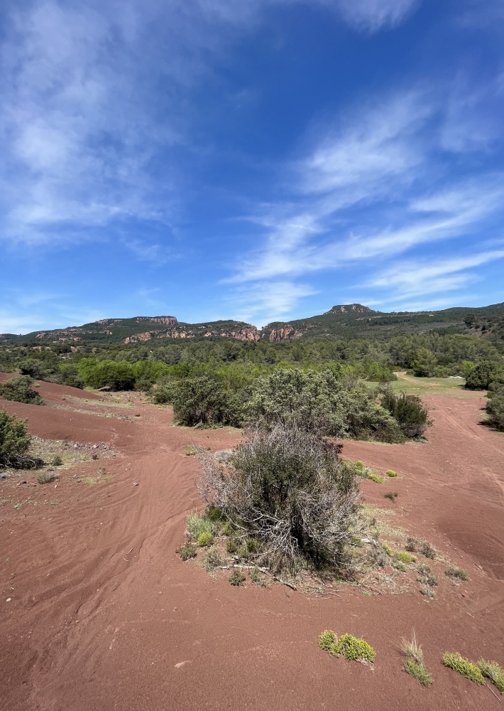
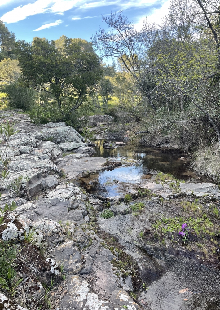
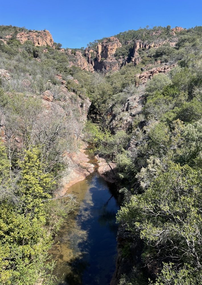
La richesse du site sur le plan environnemental est reconnue puisqu’il est protégé au titre de Natura 2000. On y trouve sur le plan faunistique et floristique de nombreuses variétés endémiques et particulières à la nature du lieu et du sol.
C’est en étudiant toutes ces caractéristiques que les sentiers et le Site du Blavet en général, ont été aménagés pour arriver… à la zone dite des grottes.

En effet ces abris sous roches ont permis voici plus de 20 000 ans à des familles
entières d’Homo Bouvérien de vivre et d’avoir selon les périodes climatiques de
quoi se nourrir par la chasse, la cueillette, voire la pêche puisque la zone fut en son temps recouverte par plus de 26 m d’eau.
Pour en avoir une idée précise, il suffit de s’imaginer sur place et de ne voir émerger que le haut du Collet Redon.
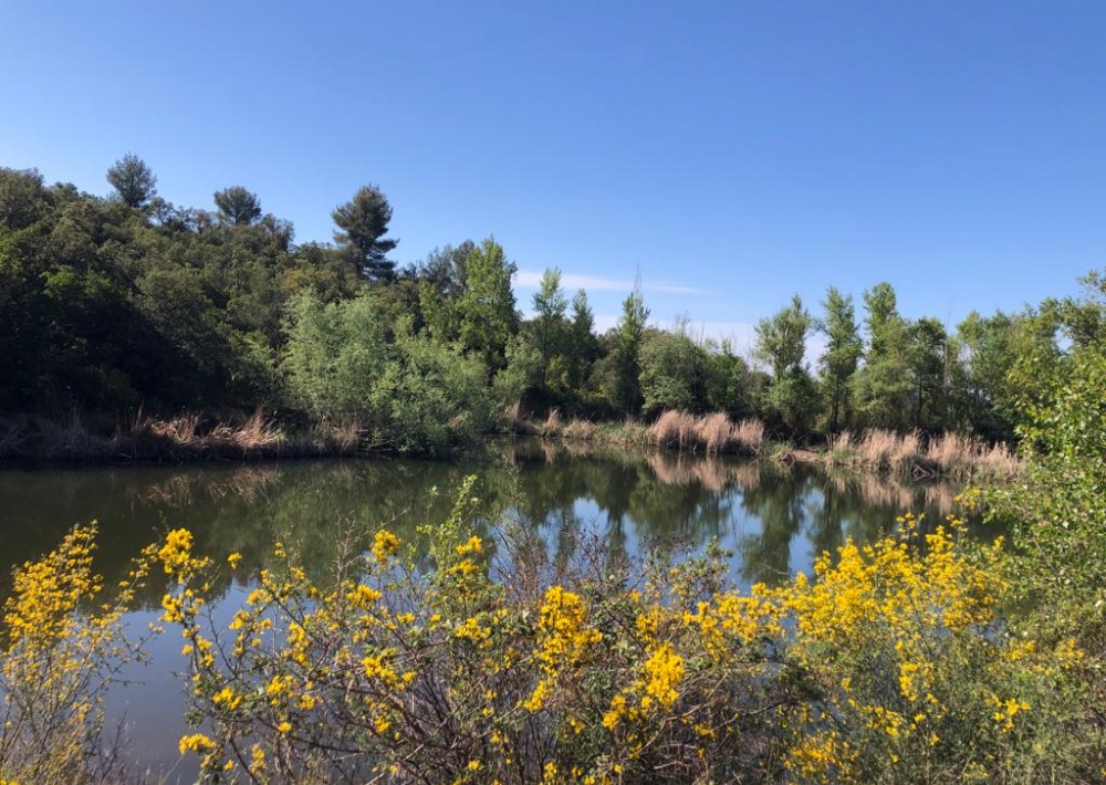
Autour de cette zone, on peut également admirer un lac, point d’eau inestimable
dans nos zones en manque de pluies régulières.

Les points d'intérêt :

1) Lac : réserve aquatique où l'on peut découvrir de nombreuses espèces protégées

2) Grottes de la Bouverie: les grottes de la Bouverie représentent la vie voici 23 000 où vécut "l'Homo Bouvérien"

3)Site d'escalade : un des sites d'escalade majeurs du Var

Le Blavet est un site naturel protégé, merci de respecter les lieux et de ne pas déranger la vie sauvage

Further information

  • flag-FRFrench
  • Type of customers : 
    Children
  • Equipments : 
    Car park
    Free car park
    Sustainable development
    Outhouse
  • On-site activities : 
    Pedestrian sports
    Hiking itinerary
Estérel Côte d'Azur depending on your mood
Weather
Sea side
Today
-- °C Wind : -- km/h
Tomorrow
-- °C Wind : -- km/h
After tomorrow
-- °C Wind : -- km/h
Hinterland
Today
-- °C Wind : -- km/h
Tomorrow
-- °C Wind : -- km/h
After tomorrow
-- °C Wind : -- km/h
Water temperature
Fréjus -- °C
Saint-Raphaël -- °C
Les Issambres -- °C
+
-

Clic on areas to zoom in

Clear map
Dark map
Map zone 1
Map zone 2
Map zone 3
Map zone 4
Map zone 5
Map zone 7
Map zone 6
Map zone 8
pays de fayence - nord

Fayence area

The Pays de Fayence (Fayence district) has many great provencal villages. All of them have a particularity such as the view from Mons or the artistic streets of Tourrettes. Do no forget to stop in Seillans that has the label of "Most beautiful village in France"

Go back to map
pays de fayence - sud

Fayence area

North of the A8 motorway, you will find the Pays de Fayence. Saint-Cassien lake, a real oasis of freshness in the Var, awaits you! Take a break at the Lake House before visiting the villages of Bagnols-en-Forêt, St-Paul-en-Forêt or Tanneron.

Go back to map
roquebrune sur argens - la bouverie

Roquebrune-sur-Argens

The city of Roquebrune-sur-Argens is the most westerly of the destination. It includes three districts: La Bouverie, at the foot of Gorges du Blavet; The village, overlooked by its magnificent rock, and Les Issambres, with its nautical activities by the sea.

Go back to map
les adrets de l'esterel

Les Adrets de l'Estérel

Les Adrets de l'Estérel is a small town located at the extreme southeastern Var. Bordering the Maritimes Alpes, it is composed of large green forests. The town overlooks the bay of Cannes and has an exceptional view on the Lérins Islands and the Corniche de l'Estérel.

Go back to map
village de puget sur argens

Puget sur Argens

Puget sur Argens is a small village located in the middle of many wineries. Its commercial area, near the village, includes many shopping center. North of the village, the Bois du Defens give rise to several walks.

Go back to map
roquebrune-sur-argens - les issambres

Les Issambres

Welcome to Les Issambres, the district of Roquebrune-sur-Argens located on the coast. True paradise with its 8 km of beaches and creeks, this family seaside resort, already frequented at the time by the Romans, is located between the Gulf of Saint-Tropez and Fréjus-Saint Raphaël.

Go back to map
ville de frejus - saint-aygulf

Fréjus

Frejus, located halfway between Cannes and Saint-Tropez, is at the heart of the Côte d'Azur. Based on a sandstone buttress of the Esterel massif, the town dominates the valleys of Argens and Reyran. Frejus has the appearance of a small Provencal town whose new districts extend to the sea.

Go back to map
saint-raphael - massif de l'esterel

Saint-Raphaël

65km from Nice Côte d'Azur International Airport, Saint-Raphaël is located between Cannes and Saint-Tropez. This seaside resort on the Mediterranean coast is at the bottom of the great Esterel mountains. Saint Raphael, whose city center is by the sea, is divided into different neighborhoods that have all their characteristics and their personalities.

Go back to map
Fayence areaFayence areaRoquebrune-sur-ArgensLes Adrets de l'EstérelPuget sur ArgensLes IssambresFréjusSaint-Raphaël
Webcams
Subscribe to our newsletter