A.Dubreuil
A.Dubreuil
Historic site and monument - 20th C

Le Chemin de Mémoire

Saint-Raphaël, the site of the Provence landings on August 15, 1944, and a member of the international foundation "The Road to the Liberation of Europe", has set up a trail dedicated to the Second World War.

Description

10 panels, from downtown to Trayas:
The route covers the Resistance, the D-Day landings and the liberation of Saint-Raphaël. Through these 10 panels, from the town center to the Trayas, Saint-Raphaël highlights the specificity of the "Camel" zone, the scene of D-Day operations. The trail is an effective way of raising awareness of this period, making up for the disappearance of eyewitnesses, and helping to pass on this history to younger generations.

In 2021, Saint-Raphaël will rightfully join the "Liberation Route Europe" Foundation, a rapidly expanding international network linking people and organizations dedicated to preserving and promoting the tangible and intangible cultural heritage linked to the Second World War, its memory and significance.

The foundation, which brings together 700 sites in a dozen countries, forms an international itinerary linking the main regions crossed during the advance of Allied troops between 1943 and 1945. Since 2019, the European Liberation Route has been recognized as a cultural route by the Council of Europe.
Saint-Raphaël's Chemin de Mémoire is part of this network.

10 emblematic sites have been selected, representative of the D-Day landings and their preparation through acts of war and resistance. Spread throughout the commune, they make up the Chemin de Mémoire.

LIST OF SITES :

1) ESPLANADE DELAYEN
A reminder that Saint-Raphaël was a hotbed of Resistance activity, with numerous networks: Nilo (Mithridate), Cotre, Carte, F2, AS, MLN, FTP-MOI, among others.

2) MONUMENT TO THE AFRICAN ARMY
Commemorative stele in honor of fallen African troops.

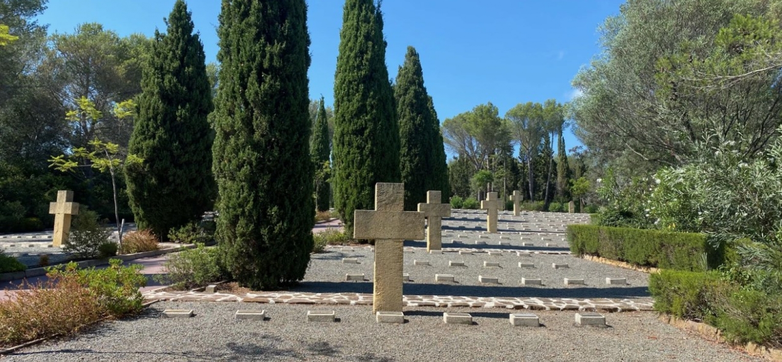
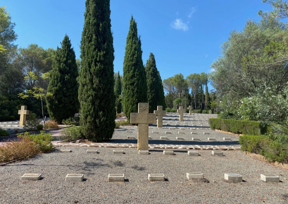
3) BOULOURIS NATIONAL NECROPOLIS
The cemetery contains the bodies of 464 soldiers of General de Lattre de Tassigny's 1st French Army, of all origins and denominations, killed during the liberation of Provence in 1944.

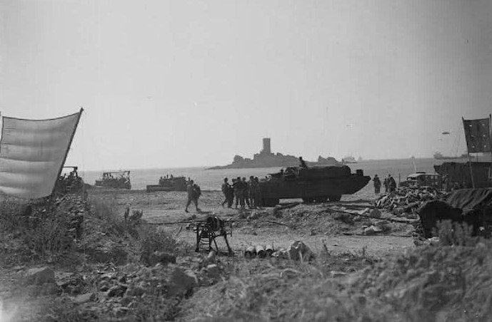
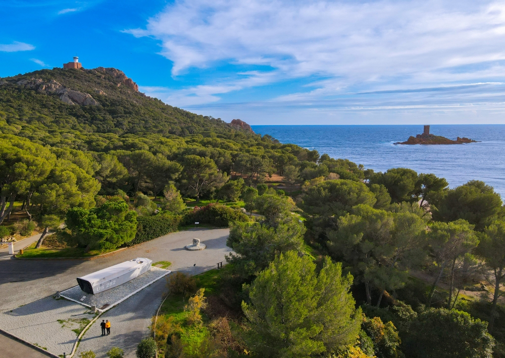
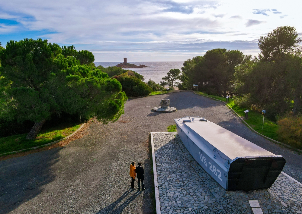
4) DRAMONT LANDING BEACH
Barge and commemorative stele in honor of the 36th Texas Infantry Division, which landed here on August 15, 1944.

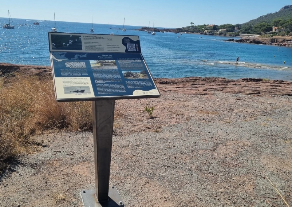
5) POURROUSSET BEACH
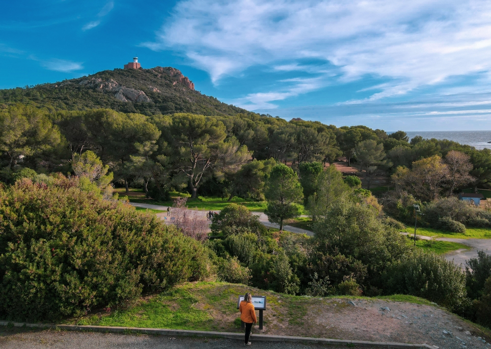
Italian and German blockhouses defending the Bay of Agay and the radars on Dramont hill, still visible.

6) AGAY BEACH
The site of a deadly Allied bombing raid on November 11, 1943, and a beach where troops and equipment were unloaded on August 15, 1944.

7) AGAY-JARDIN DE L'ORATOIRE
Stele in memory of the crew of the American bomber "Miss I Hope" shot down by German flak on May 27, 1944 in Agay Bay.

8) COL DE BELLE BARBE - ESTÉREL
Stele and grave markers in memory of the crew of the American bomber "Lucky Lady" shot down by German flak on May 25, 1944.

9) CALANQUE D'ANTHÉOR
A strategic cove due to its railway viaduct, which was destroyed during the American assault, and its position at the eastern end of the Provence landings.

10) POINTE DE L'OBSERVATOIRE
Numerous German flak pillboxes and blockhouses protecting the Anthéor viaduct can still be seen here.

Further information

  • Accepted animals
  • flag-ENEnglish
  • flag-FRFrench
  • Services : 
    Pets welcome
  • Environments : 
    Waterside
    Town location
Estérel Côte d'Azur depending on your mood
Weather
Sea side
Today
-- °C Wind : -- km/h
Tomorrow
-- °C Wind : -- km/h
After tomorrow
-- °C Wind : -- km/h
Hinterland
Today
-- °C Wind : -- km/h
Tomorrow
-- °C Wind : -- km/h
After tomorrow
-- °C Wind : -- km/h
Water temperature
Fréjus -- °C
Saint-Raphaël -- °C
Les Issambres -- °C
+
-

Clic on areas to zoom in

Clear map
Dark map
Map zone 1
Map zone 2
Map zone 3
Map zone 4
Map zone 5
Map zone 7
Map zone 6
Map zone 8
pays de fayence - nord

Fayence area

The Pays de Fayence (Fayence district) has many great provencal villages. All of them have a particularity such as the view from Mons or the artistic streets of Tourrettes. Do no forget to stop in Seillans that has the label of "Most beautiful village in France"

Go back to map
pays de fayence - sud

Fayence area

North of the A8 motorway, you will find the Pays de Fayence. Saint-Cassien lake, a real oasis of freshness in the Var, awaits you! Take a break at the Lake House before visiting the villages of Bagnols-en-Forêt, St-Paul-en-Forêt or Tanneron.

Go back to map
roquebrune sur argens - la bouverie

Roquebrune-sur-Argens

The city of Roquebrune-sur-Argens is the most westerly of the destination. It includes three districts: La Bouverie, at the foot of Gorges du Blavet; The village, overlooked by its magnificent rock, and Les Issambres, with its nautical activities by the sea.

Go back to map
les adrets de l'esterel

Les Adrets de l'Estérel

Les Adrets de l'Estérel is a small town located at the extreme southeastern Var. Bordering the Maritimes Alpes, it is composed of large green forests. The town overlooks the bay of Cannes and has an exceptional view on the Lérins Islands and the Corniche de l'Estérel.

Go back to map
village de puget sur argens

Puget sur Argens

Puget sur Argens is a small village located in the middle of many wineries. Its commercial area, near the village, includes many shopping center. North of the village, the Bois du Defens give rise to several walks.

Go back to map
roquebrune-sur-argens - les issambres

Les Issambres

Welcome to Les Issambres, the district of Roquebrune-sur-Argens located on the coast. True paradise with its 8 km of beaches and creeks, this family seaside resort, already frequented at the time by the Romans, is located between the Gulf of Saint-Tropez and Fréjus-Saint Raphaël.

Go back to map
ville de frejus - saint-aygulf

Fréjus

Frejus, located halfway between Cannes and Saint-Tropez, is at the heart of the Côte d'Azur. Based on a sandstone buttress of the Esterel massif, the town dominates the valleys of Argens and Reyran. Frejus has the appearance of a small Provencal town whose new districts extend to the sea.

Go back to map
saint-raphael - massif de l'esterel

Saint-Raphaël

65km from Nice Côte d'Azur International Airport, Saint-Raphaël is located between Cannes and Saint-Tropez. This seaside resort on the Mediterranean coast is at the bottom of the great Esterel mountains. Saint Raphael, whose city center is by the sea, is divided into different neighborhoods that have all their characteristics and their personalities.

Go back to map
Fayence areaFayence areaRoquebrune-sur-ArgensLes Adrets de l'EstérelPuget sur ArgensLes IssambresFréjusSaint-Raphaël
Webcams
Subscribe to our newsletter