Randonnée : Grand Tour de l'Ours
OT Saint-Raphaël
Pedestrian sports, Hiking itinerary

Hiking : Big bear tour

A hike that will make you discover the Estérel Massif with a beautiful view of the sea, the interior of the massif as well as the Mercantour

Description

> ACCESS
By train : TER - Le Trayas stop
By car : Take the seaside in the direction of Agay then continue on the Corniche d´Or towards Le Trayas. At the "Relais des Calanques" hotel, take the road up to the SNCF station where there is a small car park.

> STARTING POINT
GPS coordinates: 43.474951, 6.924650
Col de Notre-Dame car park

> ITINERARY
Take the track that runs along the railway line towards "Pic de l'Ours"

After 300m, take the path that starts on your right, marked with yellow markings. 450m further on, you will come across a junction where there is a pile of stones. Turn completely to your right, still following the yellow markings (do not continue straight, yellow cross).
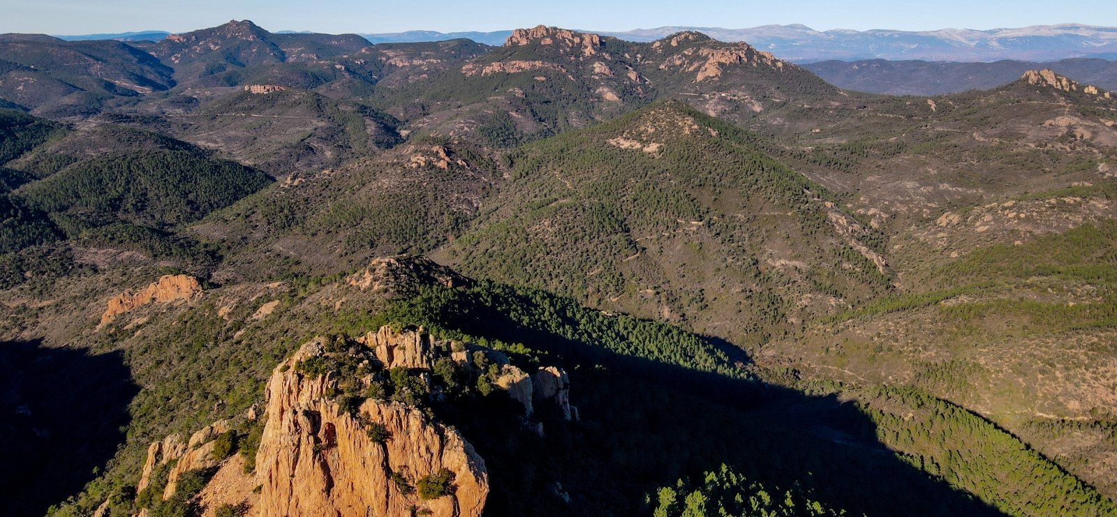
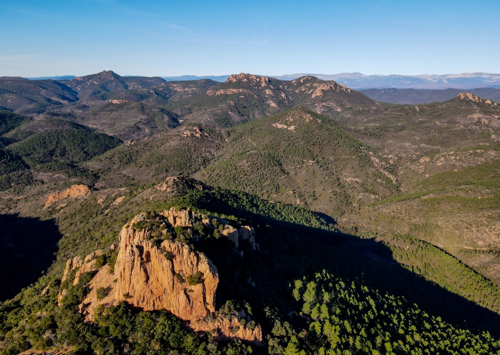
You will start to gain height and discover the Mercantour mountain.

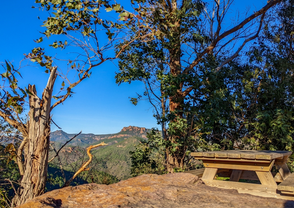
At the end of this path, after 1.3 km, you will arrive at the parking called "Col Notre Dame" where a picnic table will invite you to take a short break.
At the Col Notre Dame information panel, take the blue path heading towards the "Pic de l'Ours" then, 50m later, at the intersection, turn left following the sign "Pic de l'Ours direct".

The climb is steep and takes place in the pines on a well marked path.
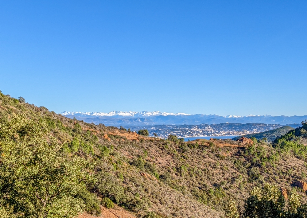
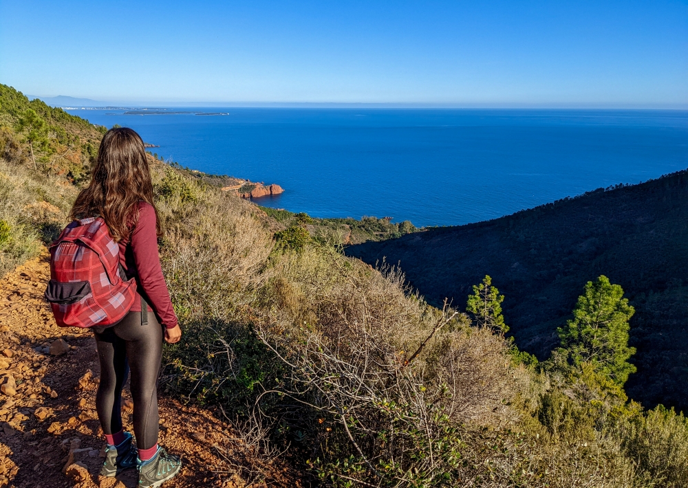
Your effort will be rewarded when you reach the top and discover the wide panorama from the viewpoint over the Lérins Islands to the bay of Saint-Raphaël Fréjus.

Continue on the road in the direction of the antenna, take the path marked out in blue which bypasses the antenna to the right. It will take you downhill to the foot of the massive Bear's Tooth rock ("dent de l'ours").

Take the yellow markings by turning left to follow the balcony path.

Enjoy the shade offered by parts of the path while admiring the view of the interior of the massif.

After 3km, you will find a road, at the crossing "Col des Lentisques", you will cross to catch up with the track still following the yellow markings. The path will lead you to your starting point.

Tips :
- Beautiful views of Esterel and the Mediterranean Sea

Further information

  • flag-FRFrench
  • Type of customers : 
    Level red – hard
  • On-site activities : 
    Pedestrian sports
    Hiking itinerary
  • Environments : 
    Mountain location
    Station district
    Close to a public transportation
    Sea view
    Panoramic view
Estérel Côte d'Azur depending on your mood
Weather
Sea side
Today
-- °C Wind : -- km/h
Tomorrow
-- °C Wind : -- km/h
After tomorrow
-- °C Wind : -- km/h
Hinterland
Today
-- °C Wind : -- km/h
Tomorrow
-- °C Wind : -- km/h
After tomorrow
-- °C Wind : -- km/h
Water temperature
Fréjus -- °C
Saint-Raphaël -- °C
Les Issambres -- °C
+
-

Clic on areas to zoom in

Clear map
Dark map
Map zone 1
Map zone 2
Map zone 3
Map zone 4
Map zone 5
Map zone 7
Map zone 6
Map zone 8
pays de fayence - nord

Fayence area

The Pays de Fayence (Fayence district) has many great provencal villages. All of them have a particularity such as the view from Mons or the artistic streets of Tourrettes. Do no forget to stop in Seillans that has the label of "Most beautiful village in France"

Go back to map
pays de fayence - sud

Fayence area

North of the A8 motorway, you will find the Pays de Fayence. Saint-Cassien lake, a real oasis of freshness in the Var, awaits you! Take a break at the Lake House before visiting the villages of Bagnols-en-Forêt, St-Paul-en-Forêt or Tanneron.

Go back to map
roquebrune sur argens - la bouverie

Roquebrune-sur-Argens

The city of Roquebrune-sur-Argens is the most westerly of the destination. It includes three districts: La Bouverie, at the foot of Gorges du Blavet; The village, overlooked by its magnificent rock, and Les Issambres, with its nautical activities by the sea.

Go back to map
les adrets de l'esterel

Les Adrets de l'Estérel

Les Adrets de l'Estérel is a small town located at the extreme southeastern Var. Bordering the Maritimes Alpes, it is composed of large green forests. The town overlooks the bay of Cannes and has an exceptional view on the Lérins Islands and the Corniche de l'Estérel.

Go back to map
village de puget sur argens

Puget sur Argens

Puget sur Argens is a small village located in the middle of many wineries. Its commercial area, near the village, includes many shopping center. North of the village, the Bois du Defens give rise to several walks.

Go back to map
roquebrune-sur-argens - les issambres

Les Issambres

Welcome to Les Issambres, the district of Roquebrune-sur-Argens located on the coast. True paradise with its 8 km of beaches and creeks, this family seaside resort, already frequented at the time by the Romans, is located between the Gulf of Saint-Tropez and Fréjus-Saint Raphaël.

Go back to map
ville de frejus - saint-aygulf

Fréjus

Frejus, located halfway between Cannes and Saint-Tropez, is at the heart of the Côte d'Azur. Based on a sandstone buttress of the Esterel massif, the town dominates the valleys of Argens and Reyran. Frejus has the appearance of a small Provencal town whose new districts extend to the sea.

Go back to map
saint-raphael - massif de l'esterel

Saint-Raphaël

65km from Nice Côte d'Azur International Airport, Saint-Raphaël is located between Cannes and Saint-Tropez. This seaside resort on the Mediterranean coast is at the bottom of the great Esterel mountains. Saint Raphael, whose city center is by the sea, is divided into different neighborhoods that have all their characteristics and their personalities.

Go back to map
Fayence areaFayence areaRoquebrune-sur-ArgensLes Adrets de l'EstérelPuget sur ArgensLes IssambresFréjusSaint-Raphaël
Webcams
Subscribe to our newsletter