Du Pic de l'Escale aux Lentisques
Saint-Raphaël Tourisme
Pedestrian sports, Hiking itinerary

Du Pic de l'Escale aux Lentisques

Discover stunning views as you venture into the heart of the Massif. This is a pleasant route with no major difficulties, offering a varied itinerary between pine forests, ravines and rocky overhangs, punctuated by sumptuous views in a rarely-visited area.

Description

> ACCESS
Drive along the seafront towards Agay. At the Agay roundabout, follow the signs for "Massif de l'Estérel". Continue for 1 km and turn right onto the small road signposted "Massif de l'Estérel". Then follow the signs for "Pic de l'Ours" for 10 km and park at the Col des Lentisques car park.

> STARTING POINT
GPS coordinates: 43.470120, 6.908596
Col des Lentisques car park.

> DIRECTIONS
From the car park, walk 400 m along the road towards Agay.

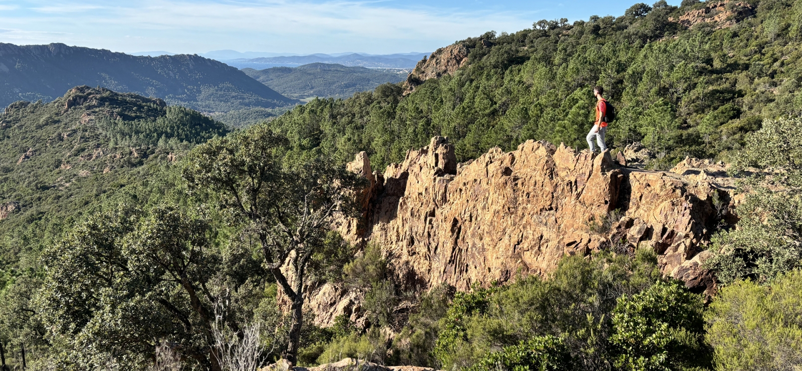
(1) You will arrive at the Baisse des Sangliers. On the right, you will see a junction made up of 2 paths. Take the left-hand path, which becomes wider uphill (yellow cross). The track climbs very gently for 1.8 km through young pine trees. The view opens out onto Cap Roux and then Rastel, with the bay of Saint-Raphaël Fréjus in the distance.

(2) You come to a fork in the road. Here, take time to admire the view from the rocky overhangs on your left.
At the fork, take the left-hand path for 100 m.

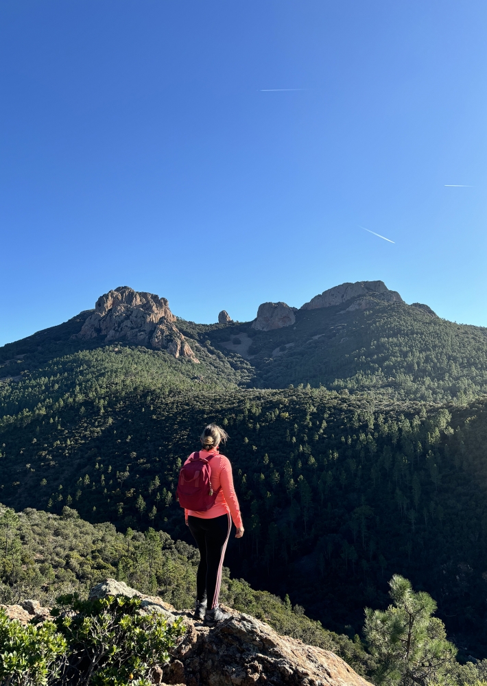
(3) At the next junction, we recommend you turn right (yellow cross) onto the small track that climbs 200 m through the forest to the summit of the Pic du Malinfernet (round trip) for a breathtaking 360° panorama, and why not take a picnic break? (4)
Return to the previous junction and turn right onto the path that begins to descend.
Enjoy the view of the Cap Roux before the path plunges down towards the Malinfernet valley.

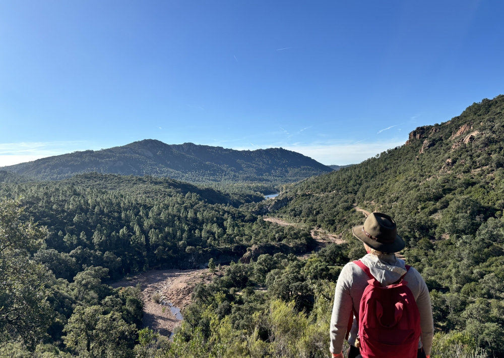
(5) After a winding descent, you reach the Malinfernet ravine and the route of the GR®51 / GR® 653A.
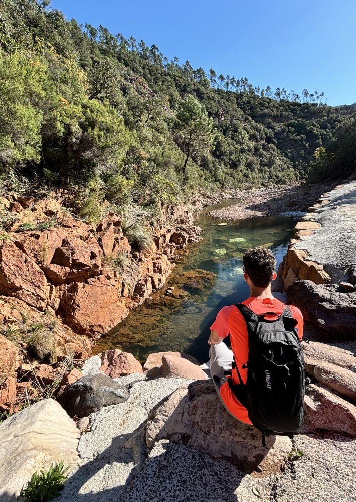
The route will start on the left. But first, we suggest a short diversion to see the Malinfernet stream (no need for a diversion in summer, when the stream is dry). Turn right and then immediately left for 50 m.
Retrace your steps as far as the fork in the path and continue to the right on the red and white GR®.

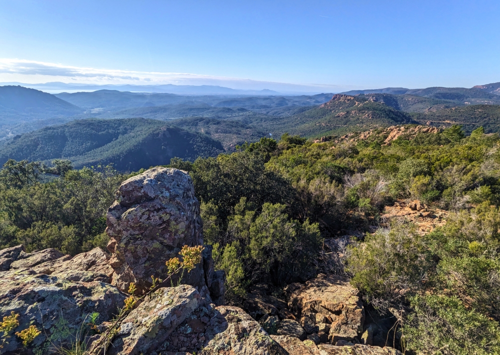
(6) The 1.5 km path overhanging the Ravin des Lentisques offers spectacular views of the summit of Cap Roux and St Pilon, and the faults below. You will pass to the right of a large boulder before reaching a new junction.

(7) Take the small path leading up to the left, marked by crosses. You now leave the GR® and climb steadily through the maritime pines towards the Baisse des Sangliers.

(8) After 2 km, you come to a U-shaped road. Walk along the road and turn left to reach the Baisse des Sangliers and then the Col des Lentisques car park, your starting point.

Further information

  • Accepted animals
  • flag-FRFrench
  • Type of customers : 
    Level bue - Medium
  • Services : 
    Pets welcome
  • On-site activities : 
    Pedestrian sports
    Hiking itinerary
  • Environments : 
    Mountain location
    Panoramic view
Estérel Côte d'Azur depending on your mood
Weather
Sea side
Today
-- °C Wind : -- km/h
Tomorrow
-- °C Wind : -- km/h
After tomorrow
-- °C Wind : -- km/h
Hinterland
Today
-- °C Wind : -- km/h
Tomorrow
-- °C Wind : -- km/h
After tomorrow
-- °C Wind : -- km/h
Water temperature
Fréjus -- °C
Saint-Raphaël -- °C
Les Issambres -- °C
+
-

Clic on areas to zoom in

Clear map
Dark map
Map zone 1
Map zone 2
Map zone 3
Map zone 4
Map zone 5
Map zone 7
Map zone 6
Map zone 8
pays de fayence - nord

Fayence area

The Pays de Fayence (Fayence district) has many great provencal villages. All of them have a particularity such as the view from Mons or the artistic streets of Tourrettes. Do no forget to stop in Seillans that has the label of "Most beautiful village in France"

Go back to map
pays de fayence - sud

Fayence area

North of the A8 motorway, you will find the Pays de Fayence. Saint-Cassien lake, a real oasis of freshness in the Var, awaits you! Take a break at the Lake House before visiting the villages of Bagnols-en-Forêt, St-Paul-en-Forêt or Tanneron.

Go back to map
roquebrune sur argens - la bouverie

Roquebrune-sur-Argens

The city of Roquebrune-sur-Argens is the most westerly of the destination. It includes three districts: La Bouverie, at the foot of Gorges du Blavet; The village, overlooked by its magnificent rock, and Les Issambres, with its nautical activities by the sea.

Go back to map
les adrets de l'esterel

Les Adrets de l'Estérel

Les Adrets de l'Estérel is a small town located at the extreme southeastern Var. Bordering the Maritimes Alpes, it is composed of large green forests. The town overlooks the bay of Cannes and has an exceptional view on the Lérins Islands and the Corniche de l'Estérel.

Go back to map
village de puget sur argens

Puget sur Argens

Puget sur Argens is a small village located in the middle of many wineries. Its commercial area, near the village, includes many shopping center. North of the village, the Bois du Defens give rise to several walks.

Go back to map
roquebrune-sur-argens - les issambres

Les Issambres

Welcome to Les Issambres, the district of Roquebrune-sur-Argens located on the coast. True paradise with its 8 km of beaches and creeks, this family seaside resort, already frequented at the time by the Romans, is located between the Gulf of Saint-Tropez and Fréjus-Saint Raphaël.

Go back to map
ville de frejus - saint-aygulf

Fréjus

Frejus, located halfway between Cannes and Saint-Tropez, is at the heart of the Côte d'Azur. Based on a sandstone buttress of the Esterel massif, the town dominates the valleys of Argens and Reyran. Frejus has the appearance of a small Provencal town whose new districts extend to the sea.

Go back to map
saint-raphael - massif de l'esterel

Saint-Raphaël

65km from Nice Côte d'Azur International Airport, Saint-Raphaël is located between Cannes and Saint-Tropez. This seaside resort on the Mediterranean coast is at the bottom of the great Esterel mountains. Saint Raphael, whose city center is by the sea, is divided into different neighborhoods that have all their characteristics and their personalities.

Go back to map
Fayence areaFayence areaRoquebrune-sur-ArgensLes Adrets de l'EstérelPuget sur ArgensLes IssambresFréjusSaint-Raphaël
Webcams
Subscribe to our newsletter