Rocher Saint-Barthélemy
Estérel Côte d'Azur
Pedestrian sports, Hiking itinerary

Rocher Saint-Barthélémy depuis la Pointe de l'Observatoire

The rock of Saint-Barthélémy offers the beautifully contrasting colours of the French Riviera's lovely blue sky and the red rocks of the Estérel massif.

Description

> ACCESS
By car from Agay:
Take the seafront road towards Agay, then stay on the seafront on the RD559 towards Cannes on the road known as the "Route de la Corniche d'Or". 7 km after Agay, park at the Pointe de l'Observatoire car park.

> STARTING POINT
GPS coordinates: 43.449364098044086, 6.917915188035244
Pointe de l'Observatoire car park

> ITINERARY
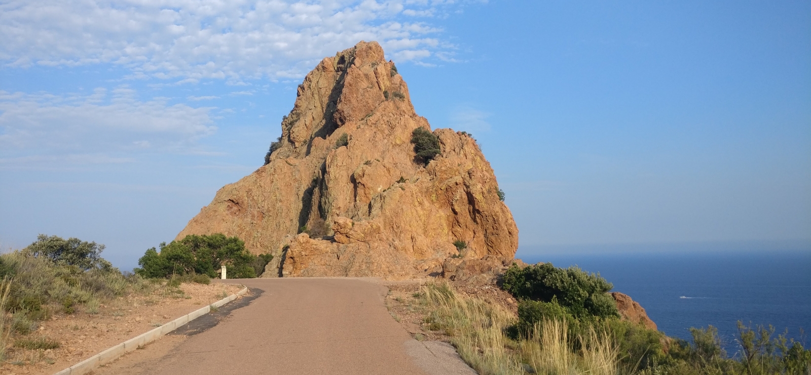
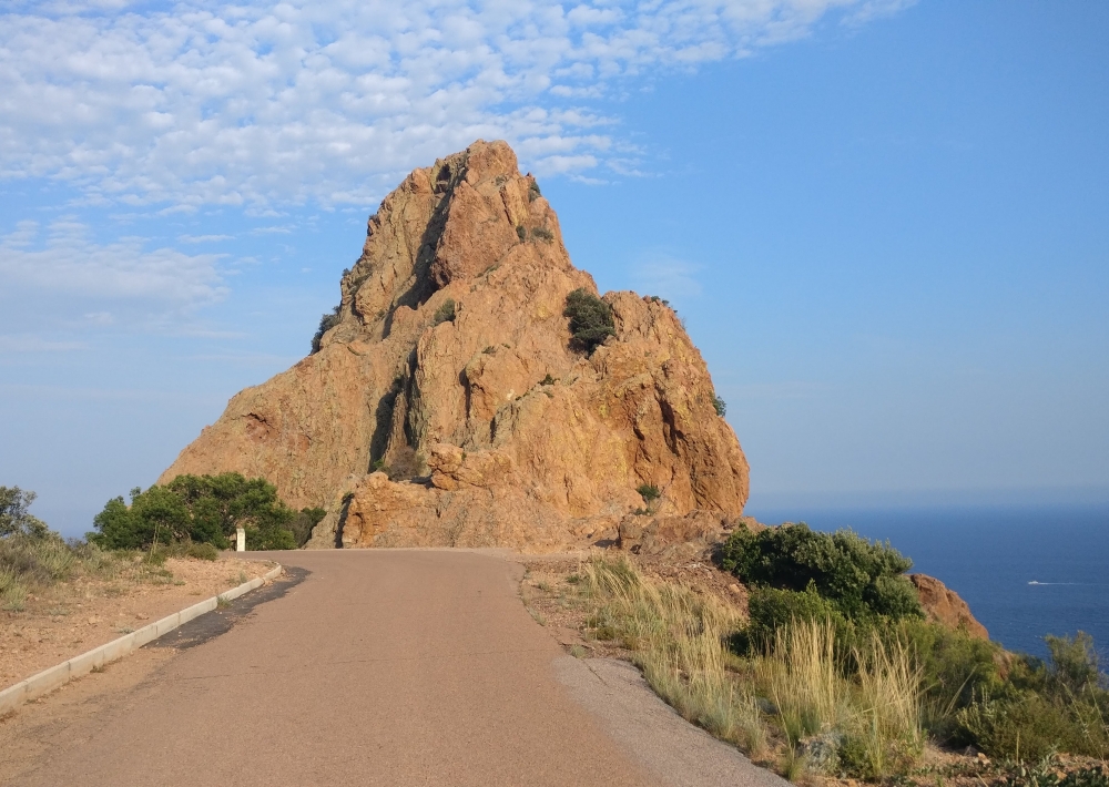
Reach the small forestry building (take care when crossing the road) and go through the barrier to take the tarmac track, which is closed to cars.

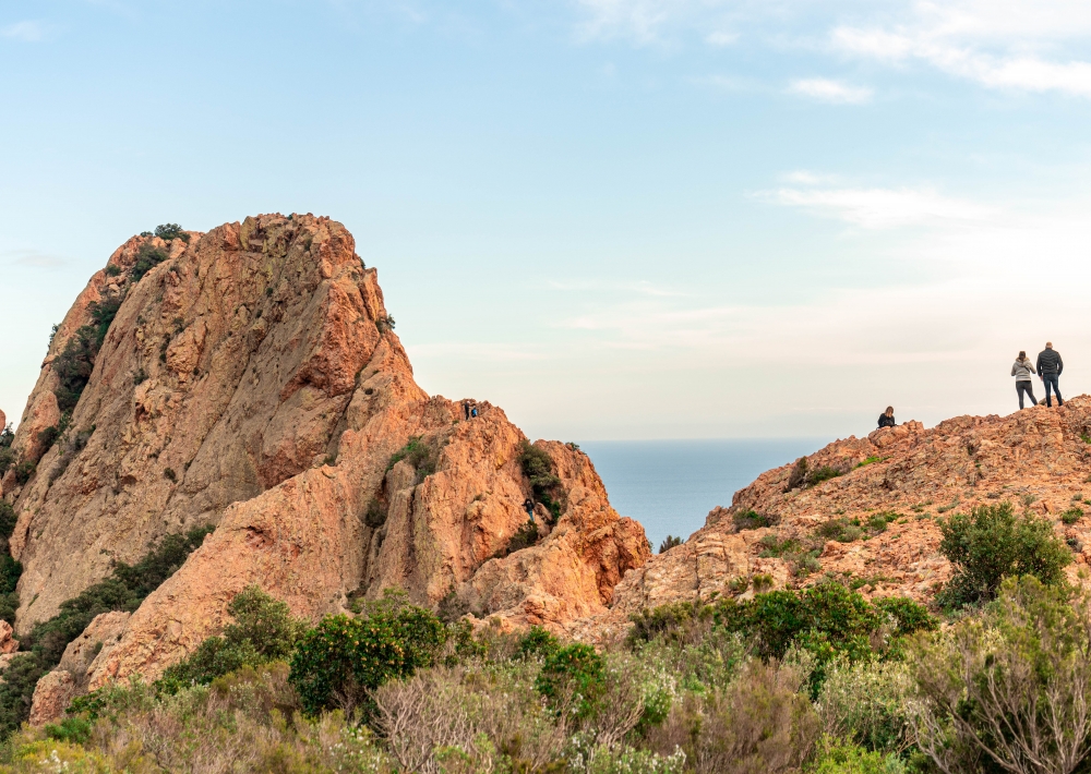
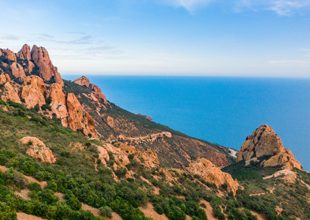
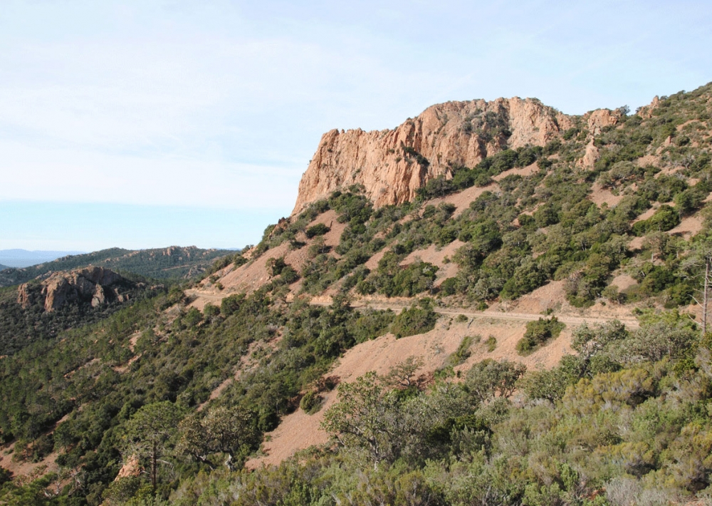
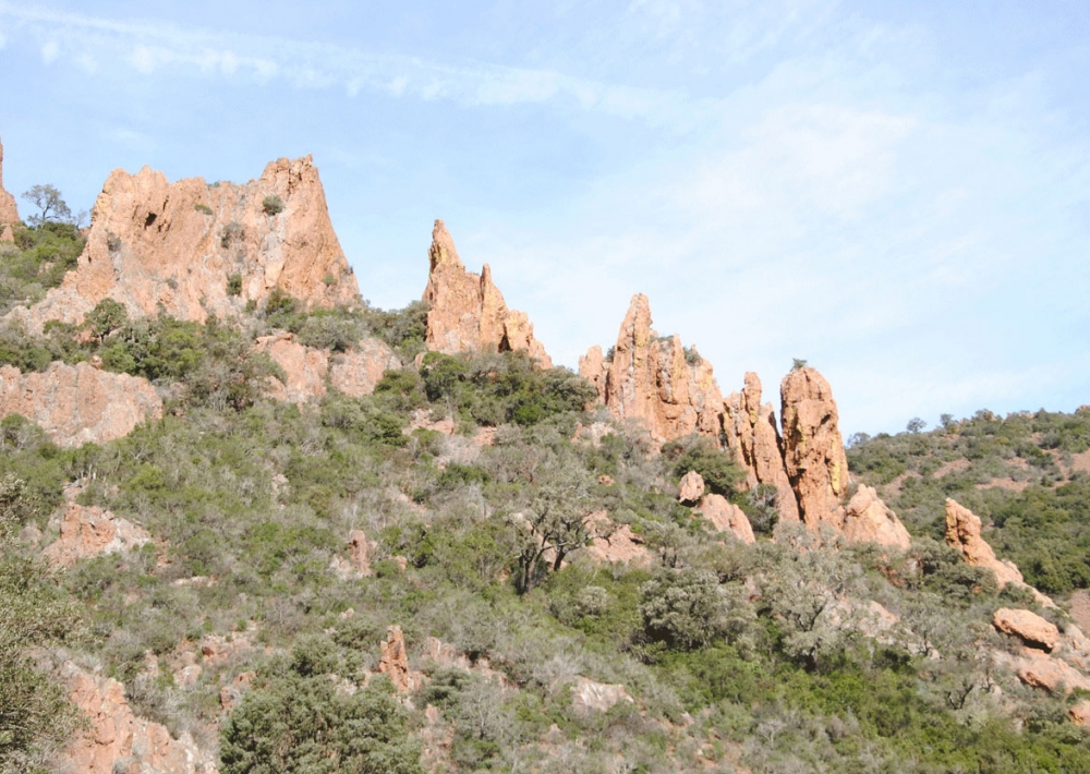
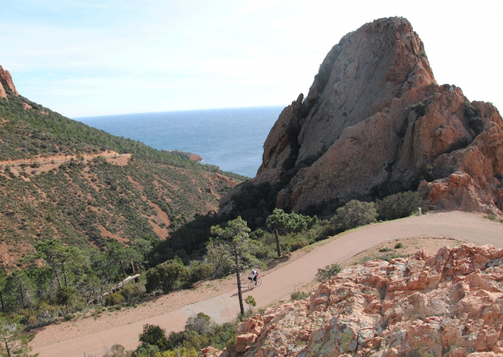
The trail climbs steadily towards the Rocher St Barthélémy for 2 km, with spectacular views of the sea, the red rocks of the Estérel and the peaks of Cap Roux.
Take the same route back.

It is possible to extend the walk past the rock for a 3 km round trip, continuing on the road that overlooks it as far as the Plateau d'Anthéor barrier.

> Be prepared: in summer, when the weather is hot and the mistral is blowing, the Massif may be closed due to the risk of fire. See the "practical information" section for daily updates.

Further information

  • Accepted animals
  • flag-FRFrench
  • Type of customers : 
    Children
    Level green – easy
  • Services : 
    Pets welcome
  • On-site activities : 
    Pedestrian sports
    Hiking itinerary
  • Environments : 
    Mountain location
    Waterside
Estérel Côte d'Azur depending on your mood
Weather
Sea side
Today
-- °C Wind : -- km/h
Tomorrow
-- °C Wind : -- km/h
After tomorrow
-- °C Wind : -- km/h
Hinterland
Today
-- °C Wind : -- km/h
Tomorrow
-- °C Wind : -- km/h
After tomorrow
-- °C Wind : -- km/h
Water temperature
Fréjus -- °C
Saint-Raphaël -- °C
Les Issambres -- °C
+
-

Clic on areas to zoom in

Clear map
Dark map
Map zone 1
Map zone 2
Map zone 3
Map zone 4
Map zone 5
Map zone 7
Map zone 6
Map zone 8
pays de fayence - nord

Fayence area

The Pays de Fayence (Fayence district) has many great provencal villages. All of them have a particularity such as the view from Mons or the artistic streets of Tourrettes. Do no forget to stop in Seillans that has the label of "Most beautiful village in France"

Go back to map
pays de fayence - sud

Fayence area

North of the A8 motorway, you will find the Pays de Fayence. Saint-Cassien lake, a real oasis of freshness in the Var, awaits you! Take a break at the Lake House before visiting the villages of Bagnols-en-Forêt, St-Paul-en-Forêt or Tanneron.

Go back to map
roquebrune sur argens - la bouverie

Roquebrune-sur-Argens

The city of Roquebrune-sur-Argens is the most westerly of the destination. It includes three districts: La Bouverie, at the foot of Gorges du Blavet; The village, overlooked by its magnificent rock, and Les Issambres, with its nautical activities by the sea.

Go back to map
les adrets de l'esterel

Les Adrets de l'Estérel

Les Adrets de l'Estérel is a small town located at the extreme southeastern Var. Bordering the Maritimes Alpes, it is composed of large green forests. The town overlooks the bay of Cannes and has an exceptional view on the Lérins Islands and the Corniche de l'Estérel.

Go back to map
village de puget sur argens

Puget sur Argens

Puget sur Argens is a small village located in the middle of many wineries. Its commercial area, near the village, includes many shopping center. North of the village, the Bois du Defens give rise to several walks.

Go back to map
roquebrune-sur-argens - les issambres

Les Issambres

Welcome to Les Issambres, the district of Roquebrune-sur-Argens located on the coast. True paradise with its 8 km of beaches and creeks, this family seaside resort, already frequented at the time by the Romans, is located between the Gulf of Saint-Tropez and Fréjus-Saint Raphaël.

Go back to map
ville de frejus - saint-aygulf

Fréjus

Frejus, located halfway between Cannes and Saint-Tropez, is at the heart of the Côte d'Azur. Based on a sandstone buttress of the Esterel massif, the town dominates the valleys of Argens and Reyran. Frejus has the appearance of a small Provencal town whose new districts extend to the sea.

Go back to map
saint-raphael - massif de l'esterel

Saint-Raphaël

65km from Nice Côte d'Azur International Airport, Saint-Raphaël is located between Cannes and Saint-Tropez. This seaside resort on the Mediterranean coast is at the bottom of the great Esterel mountains. Saint Raphael, whose city center is by the sea, is divided into different neighborhoods that have all their characteristics and their personalities.

Go back to map
Fayence areaFayence areaRoquebrune-sur-ArgensLes Adrets de l'EstérelPuget sur ArgensLes IssambresFréjusSaint-Raphaël
Webcams
Subscribe to our newsletter