Randonnée - Le tour du Cap Roux
Estérel Côte d'Azur
Pedestrian sports, Hiking itinerary

Hiking around Cap Roux

A sensational 360° panoramic view of the French Riviera from the top of Cap Roux.

Description

> ACCÈS
Emprunter le bord de mer en direction d’Agay, jusqu’au rond-point, suivre la
direction Massif de l’Estérel.

Passer sous le petit pont de la voie ferrée, dépasser la zone artisanale et, tout de
suite après, prendre à droite la petite route indiquée “Massif de l’Estérel”.

Continuer tout droit et au prochain croisement, prendre à droite direction
“Pic de l’Ours”.

Prendre la même direction au prochain croisement. S’arrêter ensuite au parking
de la Sainte-Baume.

> POINT DE DÉPART
Coordonnées GPS : 43.459047, 6.896984
Parking de la Saint-Baume

> ITINÉRAIRE
Monter l’escalier menant à la chapelle dans la roche. Continuer le chemin jusqu’à la fontaine (eau de source potable). Prendre à droite le sentier sur 50m puis
emprunter le chemin qui monte sur la gauche.

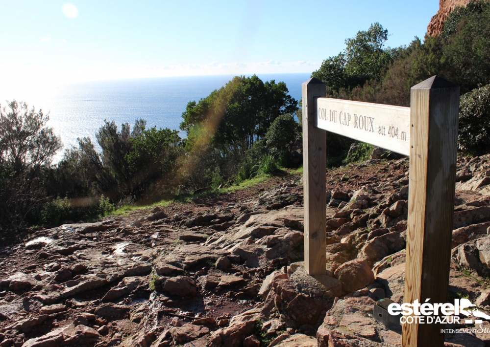
À 800m après le départ, tourner à gauche au panneau, suivre Cap Roux. Continuer pendant environ 1,5km et, à l’intersection suivante, virer complètement
à gauche pour monter vers les blocs de roches rouges du col de Saint Pilon.
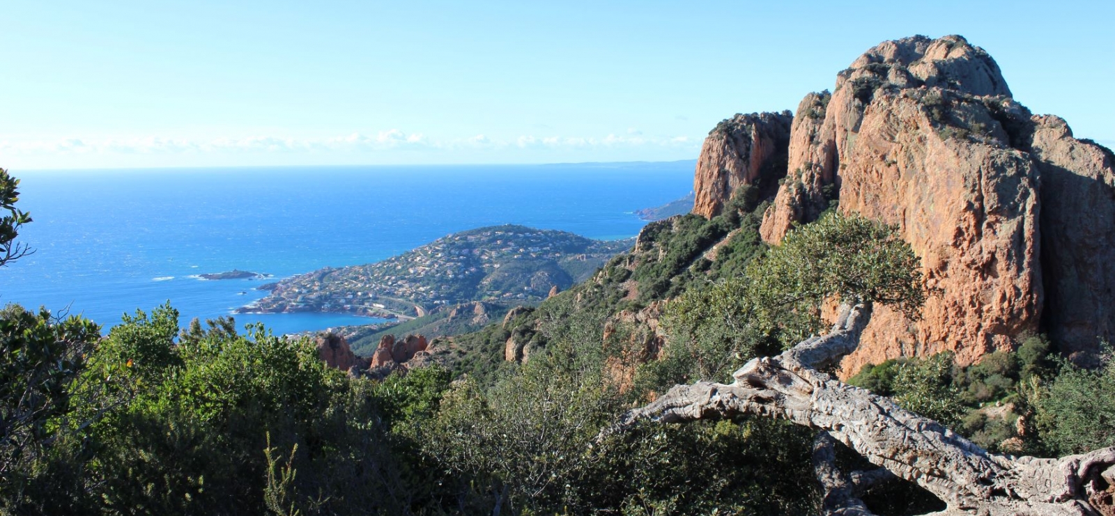
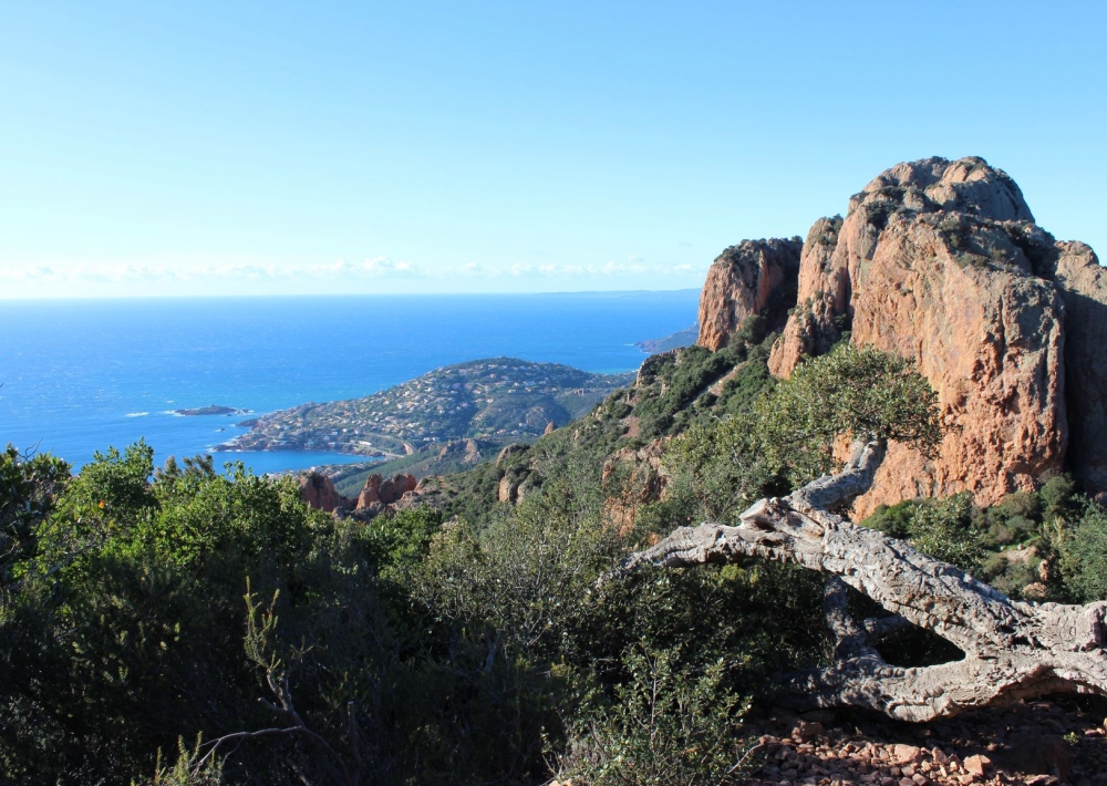
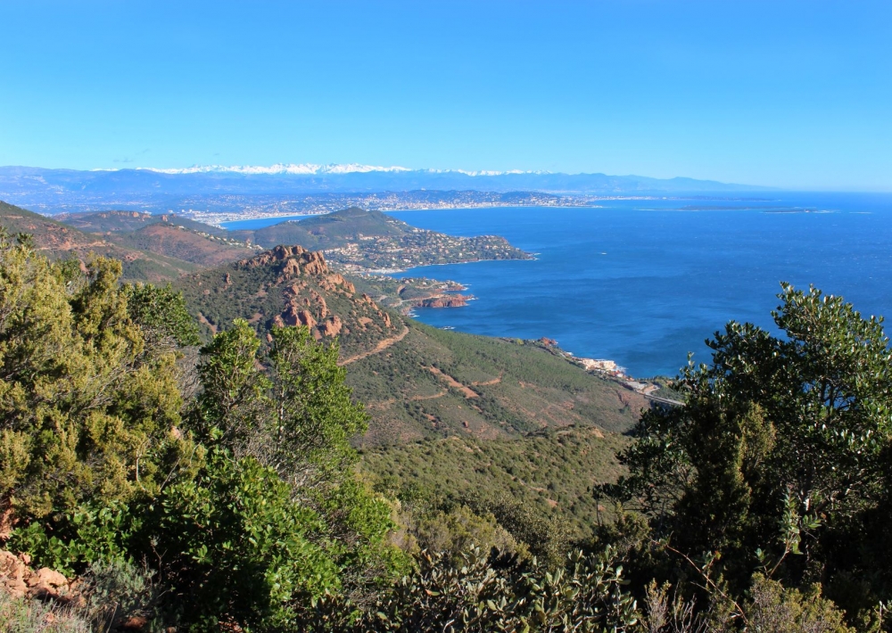
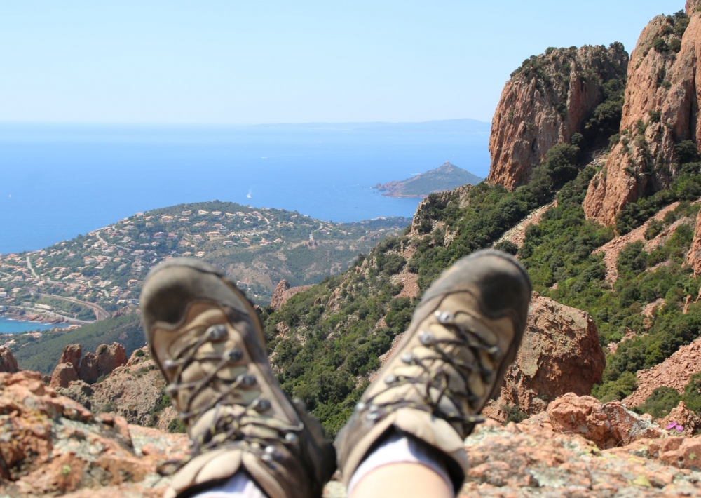
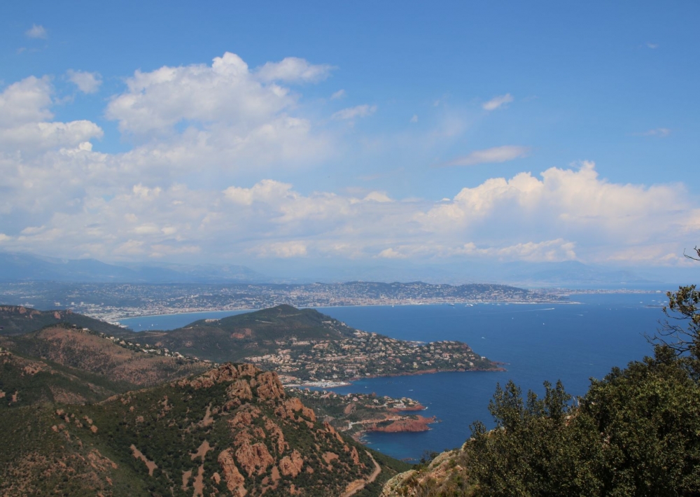
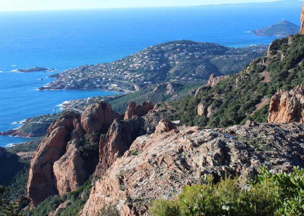
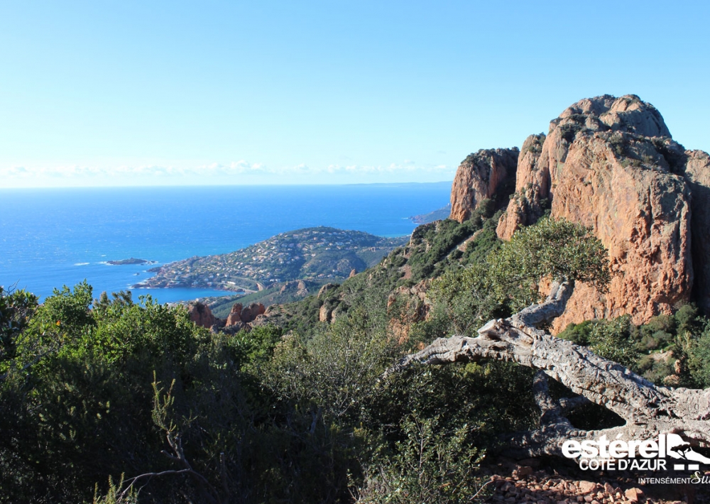
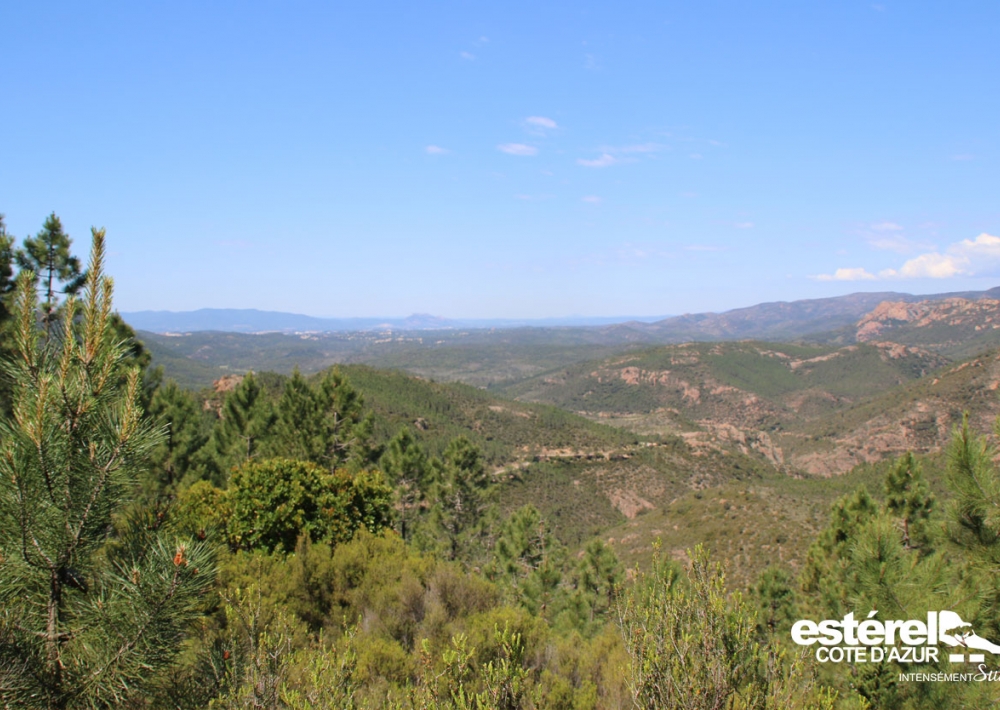
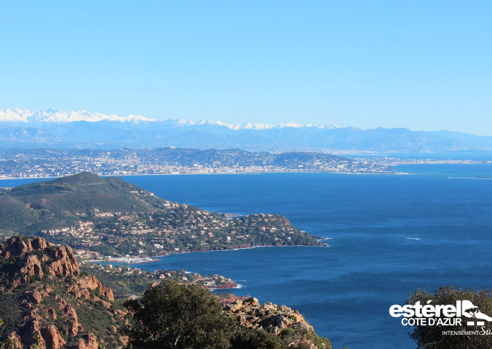
Admirer alors un panorama exceptionnel sur la côte découpée.

Le chemin longe cette corniche puis mène vers une nouvelle intersection. À
gauche, le sentier en impasse vous emmène sur 100m au sommet du Cap Roux et à sa table d’orientation (altitude de 453m avec vue de Cannes au Cap Camarat).

Redescendre par le même sentier et prendre à gauche pour continuer la balade en direction de Cannes. Quitter le côté mer du Cap Roux pour redescendre doucement vers le Massif (ne pas emprunter les sentiers partant sur la droite) pour trouver la Fontaine.

> VARIANTE : Juste avant le retour à la fontaine, un sentier monte sur votre
gauche, après des petites marches, jusqu’à la grotte de la Sainte-Baume où vécut l’ermite Saint-Honorat. (aller- retour 45mn).
Variante par le col du Saint-Pilon (5 km, 470 dénivelé positif – balisage jaune)

> Attention ! Passage aérien en montant à la grotte et passage dans un éboulis de pierre sur la dernière partie du retour.

Further information

  • flag-FRFrench
  • Type of customers : 
    Level bue - Medium
  • On-site activities : 
    Pedestrian sports
    Hiking itinerary
  • Environments : 
    Mountain location
    Sea view
    Panoramic view
Estérel Côte d'Azur depending on your mood
Weather
Sea side
Today
-- °C Wind : -- km/h
Tomorrow
-- °C Wind : -- km/h
After tomorrow
-- °C Wind : -- km/h
Hinterland
Today
-- °C Wind : -- km/h
Tomorrow
-- °C Wind : -- km/h
After tomorrow
-- °C Wind : -- km/h
Water temperature
Fréjus -- °C
Saint-Raphaël -- °C
Les Issambres -- °C
+
-

Clic on areas to zoom in

Clear map
Dark map
Map zone 1
Map zone 2
Map zone 3
Map zone 4
Map zone 5
Map zone 7
Map zone 6
Map zone 8
pays de fayence - nord

Fayence area

The Pays de Fayence (Fayence district) has many great provencal villages. All of them have a particularity such as the view from Mons or the artistic streets of Tourrettes. Do no forget to stop in Seillans that has the label of "Most beautiful village in France"

Go back to map
pays de fayence - sud

Fayence area

North of the A8 motorway, you will find the Pays de Fayence. Saint-Cassien lake, a real oasis of freshness in the Var, awaits you! Take a break at the Lake House before visiting the villages of Bagnols-en-Forêt, St-Paul-en-Forêt or Tanneron.

Go back to map
roquebrune sur argens - la bouverie

Roquebrune-sur-Argens

The city of Roquebrune-sur-Argens is the most westerly of the destination. It includes three districts: La Bouverie, at the foot of Gorges du Blavet; The village, overlooked by its magnificent rock, and Les Issambres, with its nautical activities by the sea.

Go back to map
les adrets de l'esterel

Les Adrets de l'Estérel

Les Adrets de l'Estérel is a small town located at the extreme southeastern Var. Bordering the Maritimes Alpes, it is composed of large green forests. The town overlooks the bay of Cannes and has an exceptional view on the Lérins Islands and the Corniche de l'Estérel.

Go back to map
village de puget sur argens

Puget sur Argens

Puget sur Argens is a small village located in the middle of many wineries. Its commercial area, near the village, includes many shopping center. North of the village, the Bois du Defens give rise to several walks.

Go back to map
roquebrune-sur-argens - les issambres

Les Issambres

Welcome to Les Issambres, the district of Roquebrune-sur-Argens located on the coast. True paradise with its 8 km of beaches and creeks, this family seaside resort, already frequented at the time by the Romans, is located between the Gulf of Saint-Tropez and Fréjus-Saint Raphaël.

Go back to map
ville de frejus - saint-aygulf

Fréjus

Frejus, located halfway between Cannes and Saint-Tropez, is at the heart of the Côte d'Azur. Based on a sandstone buttress of the Esterel massif, the town dominates the valleys of Argens and Reyran. Frejus has the appearance of a small Provencal town whose new districts extend to the sea.

Go back to map
saint-raphael - massif de l'esterel

Saint-Raphaël

65km from Nice Côte d'Azur International Airport, Saint-Raphaël is located between Cannes and Saint-Tropez. This seaside resort on the Mediterranean coast is at the bottom of the great Esterel mountains. Saint Raphael, whose city center is by the sea, is divided into different neighborhoods that have all their characteristics and their personalities.

Go back to map
Fayence areaFayence areaRoquebrune-sur-ArgensLes Adrets de l'EstérelPuget sur ArgensLes IssambresFréjusSaint-Raphaël
Webcams
Subscribe to our newsletter