Randonnée - Le tour du Mont Vinaigre
Estérel Côte d'Azur
Pedestrian sports, Hiking itinerary

Sentier tour du Mont Vinaigre

This hike leads to the summit of Mont Vinaigre, where you can see the bay of Cannes and Saint-Tropez. Most of the hike takes place in the shade of the massif's trees.

Description

> ACCÈS
Depuis le rond-point de l’autoroute à Fréjus (Sortie 38), suivre le panneau direction Cannes-Mandelieu.

Suivre la route du Gargalon jusqu’au rond- point Cocteau.

Prendre à gauche direction Les Adrets de l’Estérel, continuer sur 6 km jusqu’à
un carrefour pour prendre à droite.

Se garer tout de suite sur le parking situé sur la gauche ou continuer jusqu’à la maison forestière de Malpey, puis tourner à gauche, passer devant une barrière et rejoindre le parking situé 50 m plus loin.b


> POINT DE DÉPART
Coordonnées GPS : 43.501738, 6.794082
Parking du col du Testanier


> ITINÉRAIRE
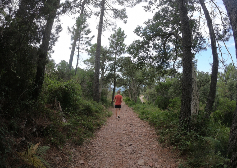
Rejoindre la barrière vue précédemment en voiture, prendre le sentier, et quelques mètres plus loin, prendre le chemin situé à droite. Profiter des tables de pique-nique avant ou après la randonnée.

Partir sur la gauche direction le Mont Vinaigre. Environ 400 mètres plus loin, franchir la barrière sur votre gauche et poursuivre sur le sentier. À la bifurcation, prendre le chemin le plus à droite.

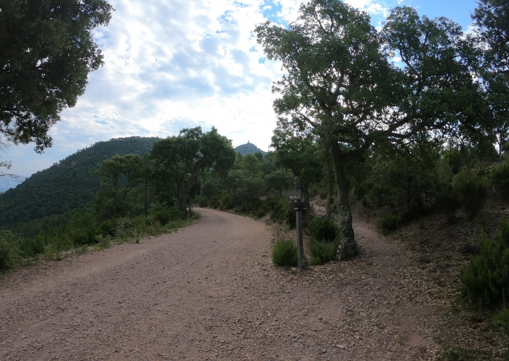
Une fois sur la route, prendre à gauche et emprunter le sentier qui se trouve directement à droite.

Continuer jusqu’à la route qui se trouve à droite pour poursuivre l’ascension.

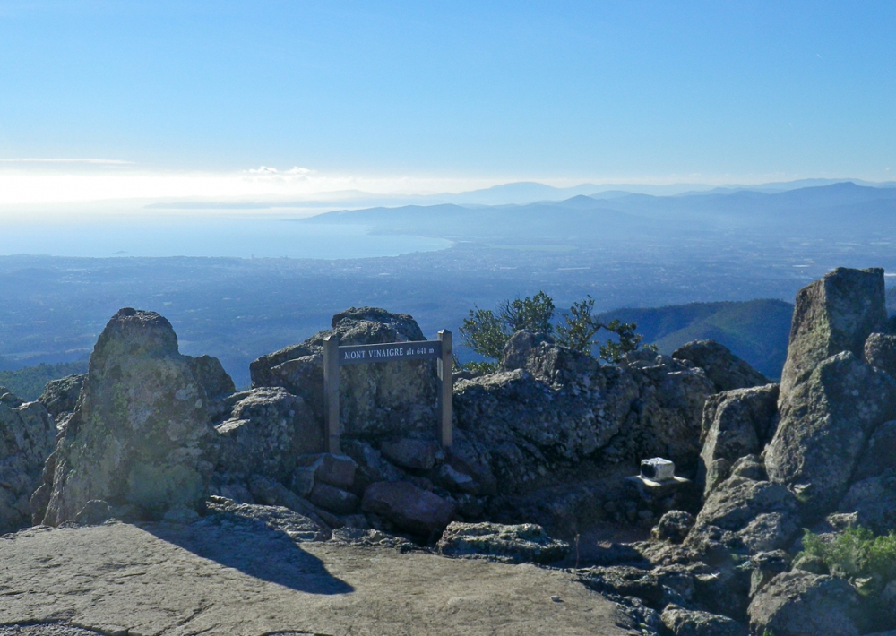
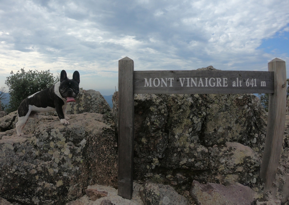
Arrivé sur une plateforme pour hélicoptère, prendre à droite jusqu’à la tour de garde. Prendre à gauche et rester sur le chemin le plus à gauche jusqu’à la plateforme du Mont Vinaigre.

Le retour se fait dans le sens opposé à l’identique.

Il existe une variante pour cette randonnée :
En redescendant, dans le virage en aiguille sur la plateforme pour hélicoptère,
un petit chemin en terre est visible sur votre gauche. Reprendre ensuite le premier chemin emprunté au départ de votre randonnée.

Further information

  • flag-FRFrench
  • Type of customers : 
    Walkers/hikers
    Level bue - Medium
  • Equipments : 
    Picnic area
    Car park
  • On-site activities : 
    Pedestrian sports
    Hiking itinerary
  • Environments : 
    Forest location
    Lake view
    Mountain location
Estérel Côte d'Azur depending on your mood
Weather
Sea side
Today
-- °C Wind : -- km/h
Tomorrow
-- °C Wind : -- km/h
After tomorrow
-- °C Wind : -- km/h
Hinterland
Today
-- °C Wind : -- km/h
Tomorrow
-- °C Wind : -- km/h
After tomorrow
-- °C Wind : -- km/h
Water temperature
Fréjus -- °C
Saint-Raphaël -- °C
Les Issambres -- °C
+
-

Clic on areas to zoom in

Clear map
Dark map
Map zone 1
Map zone 2
Map zone 3
Map zone 4
Map zone 5
Map zone 7
Map zone 6
Map zone 8
pays de fayence - nord

Fayence area

The Pays de Fayence (Fayence district) has many great provencal villages. All of them have a particularity such as the view from Mons or the artistic streets of Tourrettes. Do no forget to stop in Seillans that has the label of "Most beautiful village in France"

Go back to map
pays de fayence - sud

Fayence area

North of the A8 motorway, you will find the Pays de Fayence. Saint-Cassien lake, a real oasis of freshness in the Var, awaits you! Take a break at the Lake House before visiting the villages of Bagnols-en-Forêt, St-Paul-en-Forêt or Tanneron.

Go back to map
roquebrune sur argens - la bouverie

Roquebrune-sur-Argens

The city of Roquebrune-sur-Argens is the most westerly of the destination. It includes three districts: La Bouverie, at the foot of Gorges du Blavet; The village, overlooked by its magnificent rock, and Les Issambres, with its nautical activities by the sea.

Go back to map
les adrets de l'esterel

Les Adrets de l'Estérel

Les Adrets de l'Estérel is a small town located at the extreme southeastern Var. Bordering the Maritimes Alpes, it is composed of large green forests. The town overlooks the bay of Cannes and has an exceptional view on the Lérins Islands and the Corniche de l'Estérel.

Go back to map
village de puget sur argens

Puget sur Argens

Puget sur Argens is a small village located in the middle of many wineries. Its commercial area, near the village, includes many shopping center. North of the village, the Bois du Defens give rise to several walks.

Go back to map
roquebrune-sur-argens - les issambres

Les Issambres

Welcome to Les Issambres, the district of Roquebrune-sur-Argens located on the coast. True paradise with its 8 km of beaches and creeks, this family seaside resort, already frequented at the time by the Romans, is located between the Gulf of Saint-Tropez and Fréjus-Saint Raphaël.

Go back to map
ville de frejus - saint-aygulf

Fréjus

Frejus, located halfway between Cannes and Saint-Tropez, is at the heart of the Côte d'Azur. Based on a sandstone buttress of the Esterel massif, the town dominates the valleys of Argens and Reyran. Frejus has the appearance of a small Provencal town whose new districts extend to the sea.

Go back to map
saint-raphael - massif de l'esterel

Saint-Raphaël

65km from Nice Côte d'Azur International Airport, Saint-Raphaël is located between Cannes and Saint-Tropez. This seaside resort on the Mediterranean coast is at the bottom of the great Esterel mountains. Saint Raphael, whose city center is by the sea, is divided into different neighborhoods that have all their characteristics and their personalities.

Go back to map
Fayence areaFayence areaRoquebrune-sur-ArgensLes Adrets de l'EstérelPuget sur ArgensLes IssambresFréjusSaint-Raphaël
Webcams
Subscribe to our newsletter