VTT Baou Rouge
OTI PUGET SUR ARGENS
Cycling sports, Mountain biking itinerary

Circuit VTT : Le Baou Rouge

This family trail takes you through the entire Le Défens communal forest. Passing close to water reservoirs and at the foot of the Esterel foothills will give you a good idea of the beauty of the site.

Description

> ACCÈS
Depuis Puget sur Argens, prendre le boulevard Général Leclerc jusqu'au domaine de la Lieutenante.
Parking aménagé "au départ de l'Espace Nature"

> POINT DE DÉPART
Coordonnées GPS : 43.496599, 6.696332
Aire Guy Manganelli

> ITINÉRAIRE
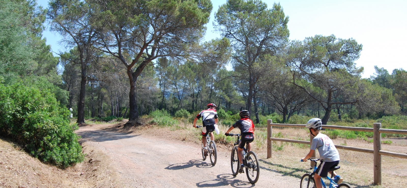
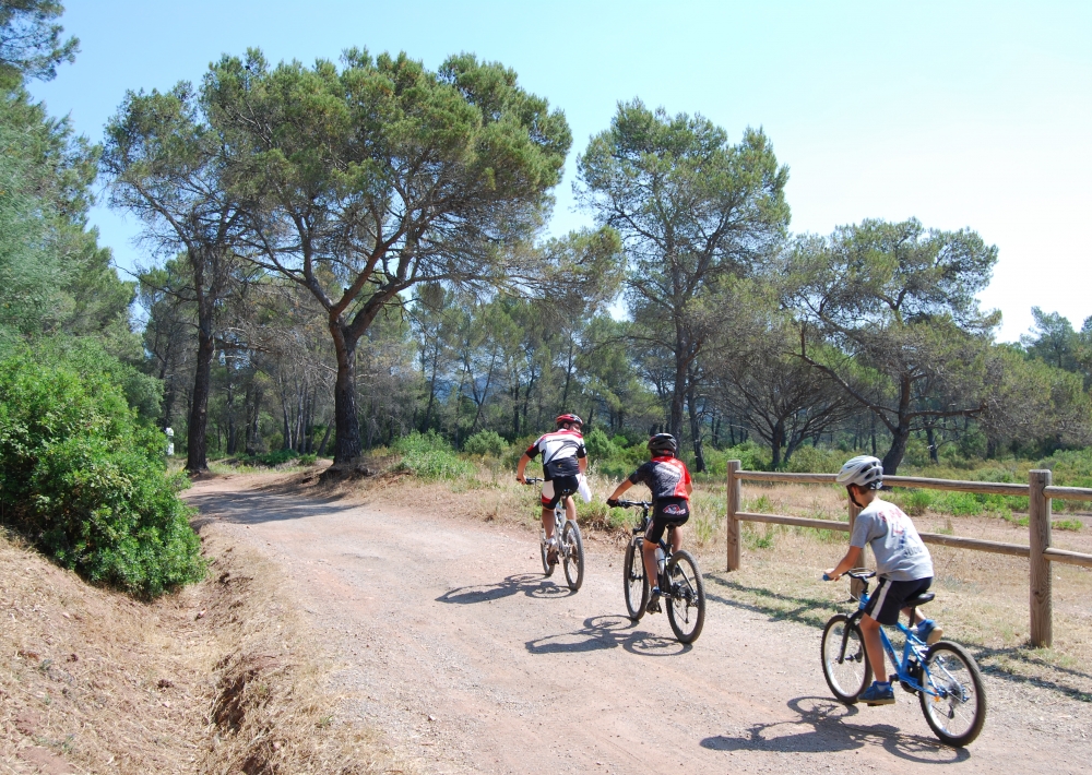
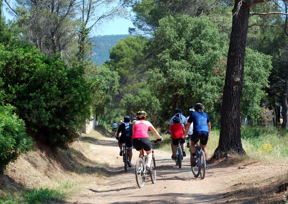
Après avoir pris note des informations inscrites sur le panneau informatif situé au bout du parking, emprunter la piste des lauriers sur 200 mètres pour arriver à la première balise. Suivre ensuite les lames directionnelles oranges positionnées tout au long du circuit, portant la mention "Baou Rouge" itinéraire 6.

Entamer votre balade sans difficultés particulières en roulant sur plusieurs kilomètres sur une piste rectiligne. Continuer ensuite sur le parcours devenant plus vallonée jusqu'à la balise n°4 (ancienne piste des abeilles).
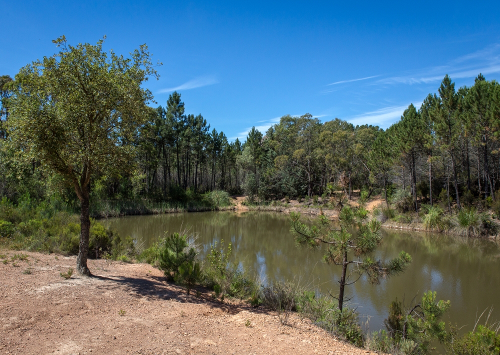
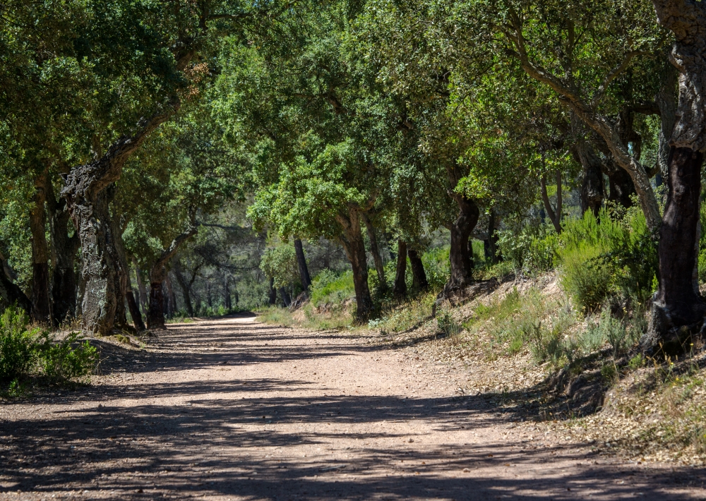
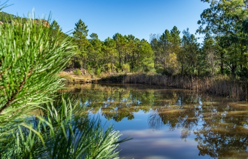
Pour prendre une pause aux abords d'un lac, sortir du balisage et se rendre en contrebas de la balise n°4. Poursuivre sur le chemin en suivant l'itinéraire orangé n°4 "Baou Rouge". Après être passé à proximité de l'entrée de la piste de la Pierre du col du Coucou, qui relie Puget sur Argens à Bagnols en Forêt, et toujours en suivant le fléchage, entamer une descente jusqu'à la balise n°8 indiquant la direction à gauche. Continuer sur des côtes successives jusqu'à atteindre deux petits lacs. Pour finir, rouler en grande partie en descente jusqu'au point de départ.

Attention le balisage est retiré durant la période de chasse entre septembre et février de chaque année.

Further information

  • Accepted animals
  • flag-FRFrench
  • Type of customers : 
    Level bue - Medium
    For beginners / novice
  • Services : 
    Pets welcome
  • Equipments : 
    Picnic area
    Car park
    Free car park
  • On-site activities : 
    Cycling sports
    Mountain biking itinerary
  • Environments : 
    Forest location
Estérel Côte d'Azur depending on your mood
Weather
Sea side
Today
-- °C Wind : -- km/h
Tomorrow
-- °C Wind : -- km/h
After tomorrow
-- °C Wind : -- km/h
Hinterland
Today
-- °C Wind : -- km/h
Tomorrow
-- °C Wind : -- km/h
After tomorrow
-- °C Wind : -- km/h
Water temperature
Fréjus -- °C
Saint-Raphaël -- °C
Les Issambres -- °C
+
-

Clic on areas to zoom in

Clear map
Dark map
Map zone 1
Map zone 2
Map zone 3
Map zone 4
Map zone 5
Map zone 7
Map zone 6
Map zone 8
pays de fayence - nord

Fayence area

The Pays de Fayence (Fayence district) has many great provencal villages. All of them have a particularity such as the view from Mons or the artistic streets of Tourrettes. Do no forget to stop in Seillans that has the label of "Most beautiful village in France"

Go back to map
pays de fayence - sud

Fayence area

North of the A8 motorway, you will find the Pays de Fayence. Saint-Cassien lake, a real oasis of freshness in the Var, awaits you! Take a break at the Lake House before visiting the villages of Bagnols-en-Forêt, St-Paul-en-Forêt or Tanneron.

Go back to map
roquebrune sur argens - la bouverie

Roquebrune-sur-Argens

The city of Roquebrune-sur-Argens is the most westerly of the destination. It includes three districts: La Bouverie, at the foot of Gorges du Blavet; The village, overlooked by its magnificent rock, and Les Issambres, with its nautical activities by the sea.

Go back to map
les adrets de l'esterel

Les Adrets de l'Estérel

Les Adrets de l'Estérel is a small town located at the extreme southeastern Var. Bordering the Maritimes Alpes, it is composed of large green forests. The town overlooks the bay of Cannes and has an exceptional view on the Lérins Islands and the Corniche de l'Estérel.

Go back to map
village de puget sur argens

Puget sur Argens

Puget sur Argens is a small village located in the middle of many wineries. Its commercial area, near the village, includes many shopping center. North of the village, the Bois du Defens give rise to several walks.

Go back to map
roquebrune-sur-argens - les issambres

Les Issambres

Welcome to Les Issambres, the district of Roquebrune-sur-Argens located on the coast. True paradise with its 8 km of beaches and creeks, this family seaside resort, already frequented at the time by the Romans, is located between the Gulf of Saint-Tropez and Fréjus-Saint Raphaël.

Go back to map
ville de frejus - saint-aygulf

Fréjus

Frejus, located halfway between Cannes and Saint-Tropez, is at the heart of the Côte d'Azur. Based on a sandstone buttress of the Esterel massif, the town dominates the valleys of Argens and Reyran. Frejus has the appearance of a small Provencal town whose new districts extend to the sea.

Go back to map
saint-raphael - massif de l'esterel

Saint-Raphaël

65km from Nice Côte d'Azur International Airport, Saint-Raphaël is located between Cannes and Saint-Tropez. This seaside resort on the Mediterranean coast is at the bottom of the great Esterel mountains. Saint Raphael, whose city center is by the sea, is divided into different neighborhoods that have all their characteristics and their personalities.

Go back to map
Fayence areaFayence areaRoquebrune-sur-ArgensLes Adrets de l'EstérelPuget sur ArgensLes IssambresFréjusSaint-Raphaël
Webcams
Subscribe to our newsletter