Rando lucioles 2019
Mairie de Roquebrune sur argens
Nature and relaxation, Sports and leisure, Entertainment/recreation - Competitive sport, Local festival

Les Lucioles

The Lucioles hike and trail is the must-do sporting event in Roquebrune-sur-Argens. Equipped with a headlamp, the participants set off into the forest massifs on marked and secure paths.

20 avril 24

Description

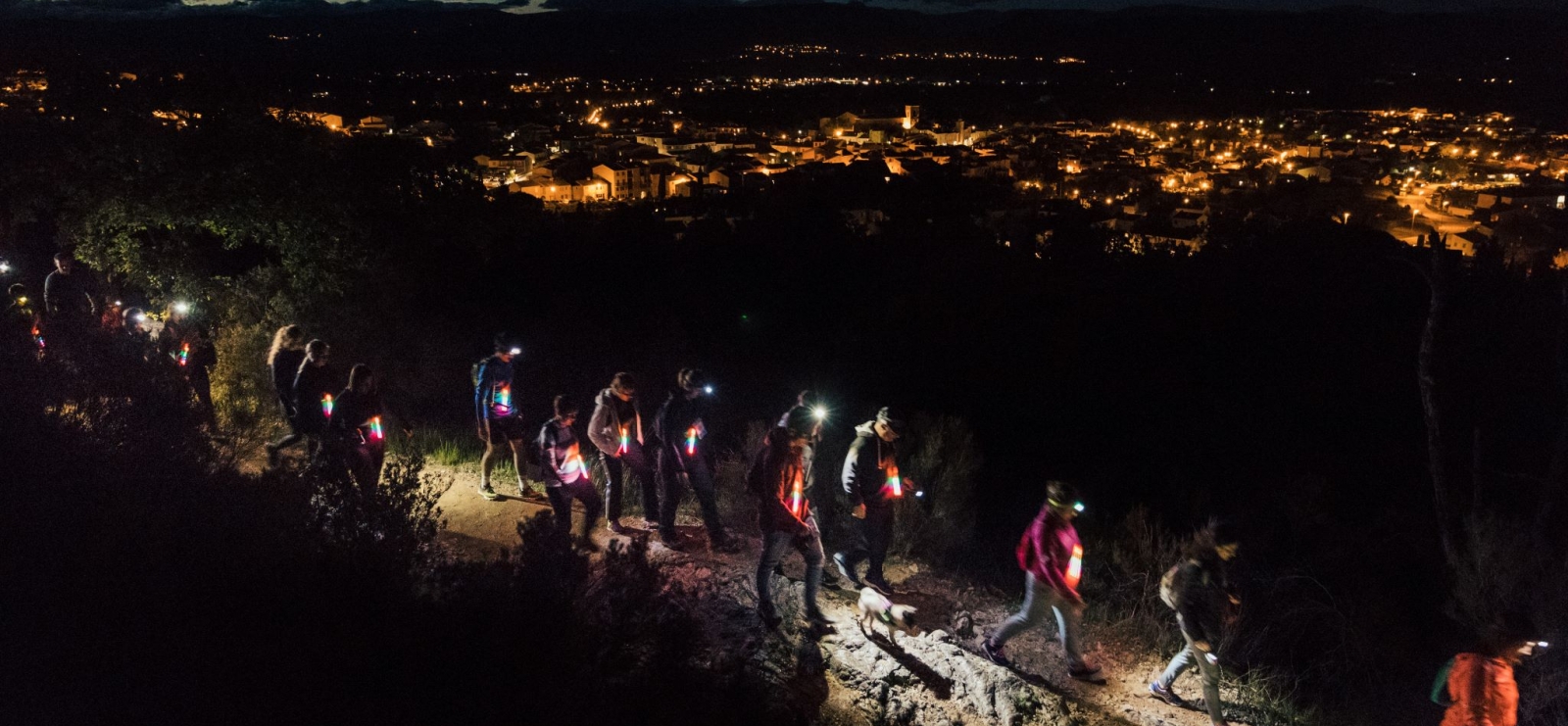
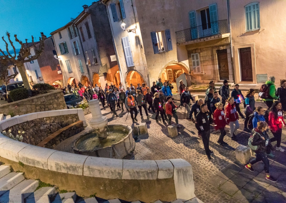
The headlamps are gradually lit up. The participants line up at the starting line. Bibs on their backs, the starting signal is given for a hike or trail under the stars in the forest between the village and the foot of the Rocher de Roquebrune.
A safe race on marked paths, with some technical passages.
For this 17th edition :
- up to 500 trailers will be able to set off on a timed race of 14 km D+400
- up to 2500 hikers will survey the massif over 7km or 14 km (departure in 5 waves)
- the youngest, born between 2010 and 2016, will be able to do dedicated races of 1 or 2 km.

Course of the event
18H00: Welcome, collection of race numbers until 22h30
7.30 pm: Children's race
9.00 pm: Start and finish of the runners at Place Germain Ollier
9.10 pm: Start of the walkers in 5 waves of 300 (9.10 pm, 9.30 pm, 9.50 pm, 10.10 pm, 10.30 pm)
9.30 pm : Arrival of the first runners at Germain Ollier square
10.45pm: Awarding of prizes as the runners finish
23h30 : Arrival of the last runner
02h00 : Arrival of the last walker, closing of the course

All registrations are online at sportips.fr before 27 April 2023 (no on-site registration).

Further information

  • flag-FRFrench
  • Type of customers : 
    Walkers/hikers
  • Services : 
    Restaurant
  • Equipments : 
    Car park
    Parking
    Free car park
  • Environments : 
    Forest location
Estérel Côte d'Azur depending on your mood
Weather
Sea side
Today
-- °C Wind : -- km/h
Tomorrow
-- °C Wind : -- km/h
After tomorrow
-- °C Wind : -- km/h
Hinterland
Today
-- °C Wind : -- km/h
Tomorrow
-- °C Wind : -- km/h
After tomorrow
-- °C Wind : -- km/h
Water temperature
Fréjus -- °C
Saint-Raphaël -- °C
Les Issambres -- °C
+
-

Clic on areas to zoom in

Clear map
Dark map
Map zone 1
Map zone 2
Map zone 3
Map zone 4
Map zone 5
Map zone 7
Map zone 6
Map zone 8
pays de fayence - nord

Fayence area

The Pays de Fayence (Fayence district) has many great provencal villages. All of them have a particularity such as the view from Mons or the artistic streets of Tourrettes. Do no forget to stop in Seillans that has the label of "Most beautiful village in France"

Go back to map
pays de fayence - sud

Fayence area

North of the A8 motorway, you will find the Pays de Fayence. Saint-Cassien lake, a real oasis of freshness in the Var, awaits you! Take a break at the Lake House before visiting the villages of Bagnols-en-Forêt, St-Paul-en-Forêt or Tanneron.

Go back to map
roquebrune sur argens - la bouverie

Roquebrune-sur-Argens

The city of Roquebrune-sur-Argens is the most westerly of the destination. It includes three districts: La Bouverie, at the foot of Gorges du Blavet; The village, overlooked by its magnificent rock, and Les Issambres, with its nautical activities by the sea.

Go back to map
les adrets de l'esterel

Les Adrets de l'Estérel

Les Adrets de l'Estérel is a small town located at the extreme southeastern Var. Bordering the Maritimes Alpes, it is composed of large green forests. The town overlooks the bay of Cannes and has an exceptional view on the Lérins Islands and the Corniche de l'Estérel.

Go back to map
village de puget sur argens

Puget sur Argens

Puget sur Argens is a small village located in the middle of many wineries. Its commercial area, near the village, includes many shopping center. North of the village, the Bois du Defens give rise to several walks.

Go back to map
roquebrune-sur-argens - les issambres

Les Issambres

Welcome to Les Issambres, the district of Roquebrune-sur-Argens located on the coast. True paradise with its 8 km of beaches and creeks, this family seaside resort, already frequented at the time by the Romans, is located between the Gulf of Saint-Tropez and Fréjus-Saint Raphaël.

Go back to map
ville de frejus - saint-aygulf

Fréjus

Frejus, located halfway between Cannes and Saint-Tropez, is at the heart of the Côte d'Azur. Based on a sandstone buttress of the Esterel massif, the town dominates the valleys of Argens and Reyran. Frejus has the appearance of a small Provencal town whose new districts extend to the sea.

Go back to map
saint-raphael - massif de l'esterel

Saint-Raphaël

65km from Nice Côte d'Azur International Airport, Saint-Raphaël is located between Cannes and Saint-Tropez. This seaside resort on the Mediterranean coast is at the bottom of the great Esterel mountains. Saint Raphael, whose city center is by the sea, is divided into different neighborhoods that have all their characteristics and their personalities.

Go back to map
Fayence areaFayence areaRoquebrune-sur-ArgensLes Adrets de l'EstérelPuget sur ArgensLes IssambresFréjusSaint-Raphaël
Webcams
Subscribe to our newsletter