Randonnée Le Tour du Pic de l'Ours
Estérel Côte d'Azur
Pedestrian sports, Hiking itinerary

Hiking to the Pic de l'Ours

An itinerary that explores the Estérel massif where the paths, often steep, offer uninterrupted views over the red rocks and the blue sea.

Description

> ACCÈS
Depuis Saint-Raphaël, prendre la direction du quartier Valescure, indiqué par des panneaux, puis tourner à droite sur le boulevard Jacques Baudino.

Continuer tout droit sur avenue des Golfs et environ 3 km plus loin, tourner à gauche sur la rue du Gratadis.

Continuer sur cette même route. Arrivé à une bifurcation, prendre à droite et traverser le cours d’eau du Grenouillet.

Continuer sur une dizaine de kilomètres sur la même route pour tomber sur le parking du col Notre-Dame.

> POINT DE DÉPART
Coordonnées GPS : 43.480487, 6.911751
Parking du Col de Notre-Dame

> ITINÉRAIRE
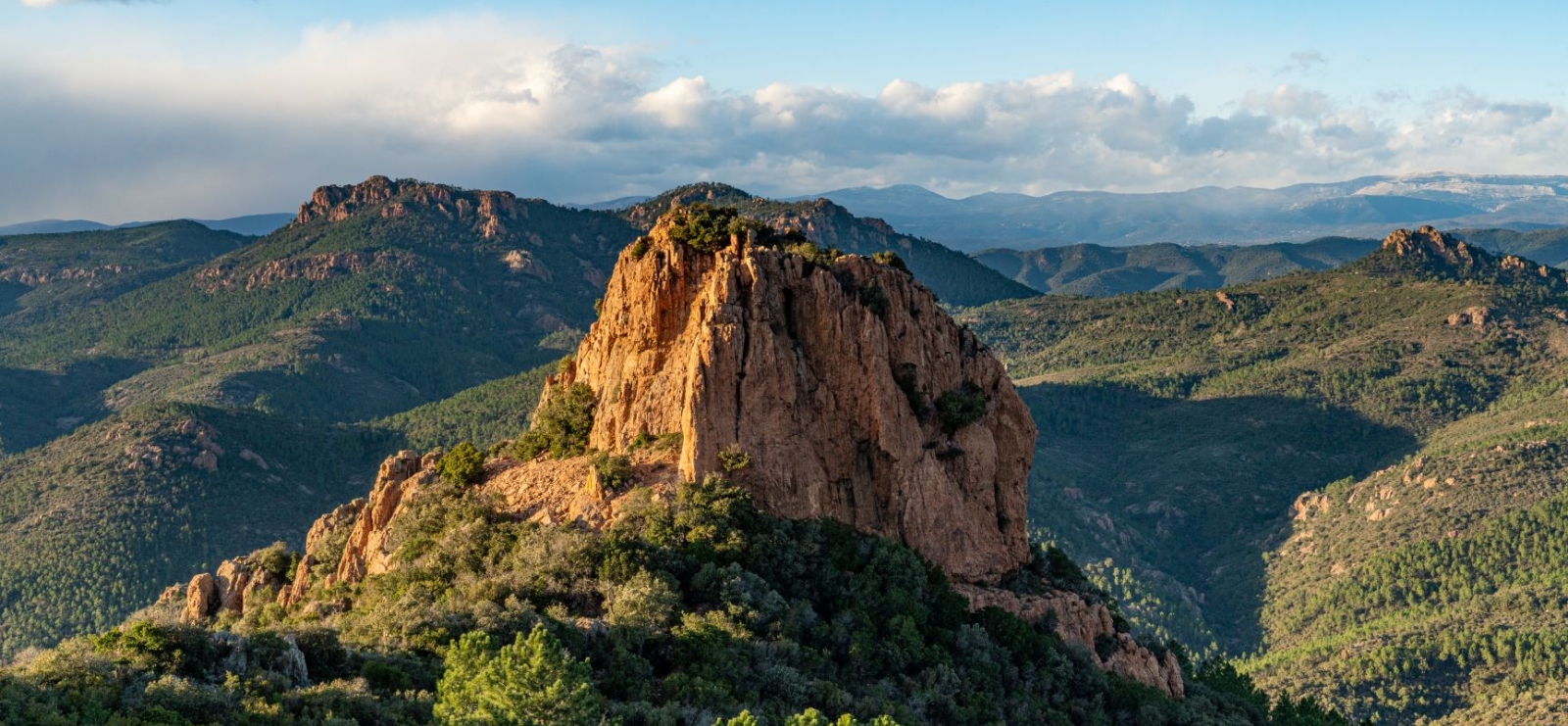
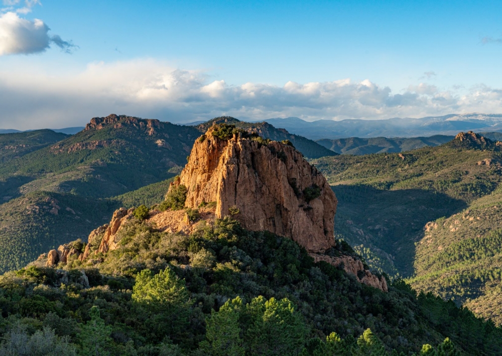
À côté du panneau décrivant les sentiers, une pancarte Pic de l’Ours indique le chemin à emprunter.

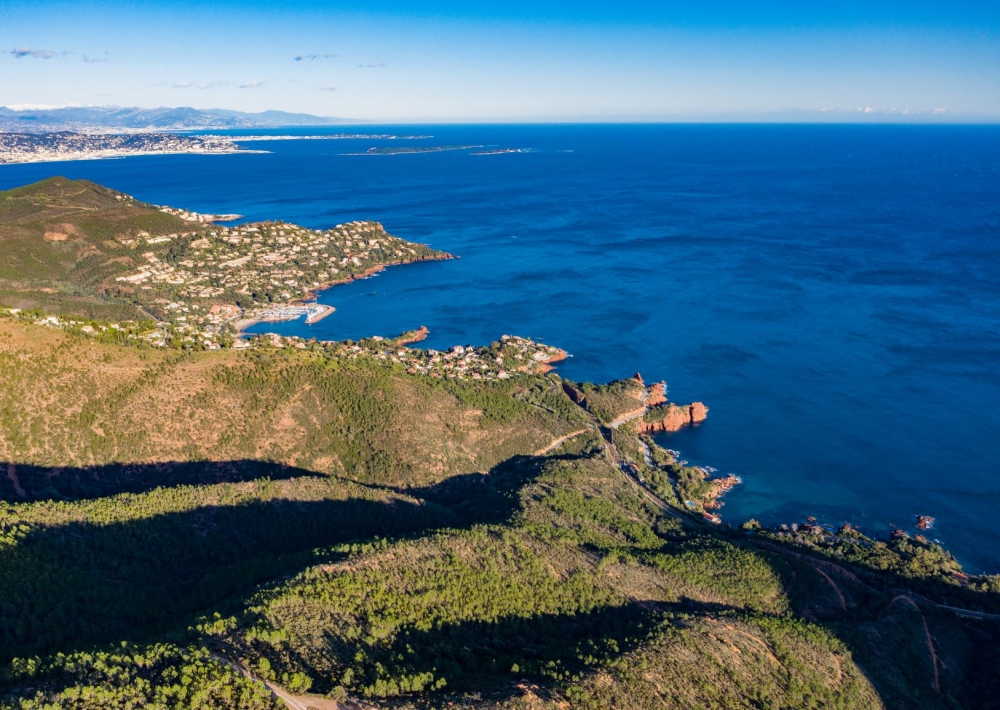
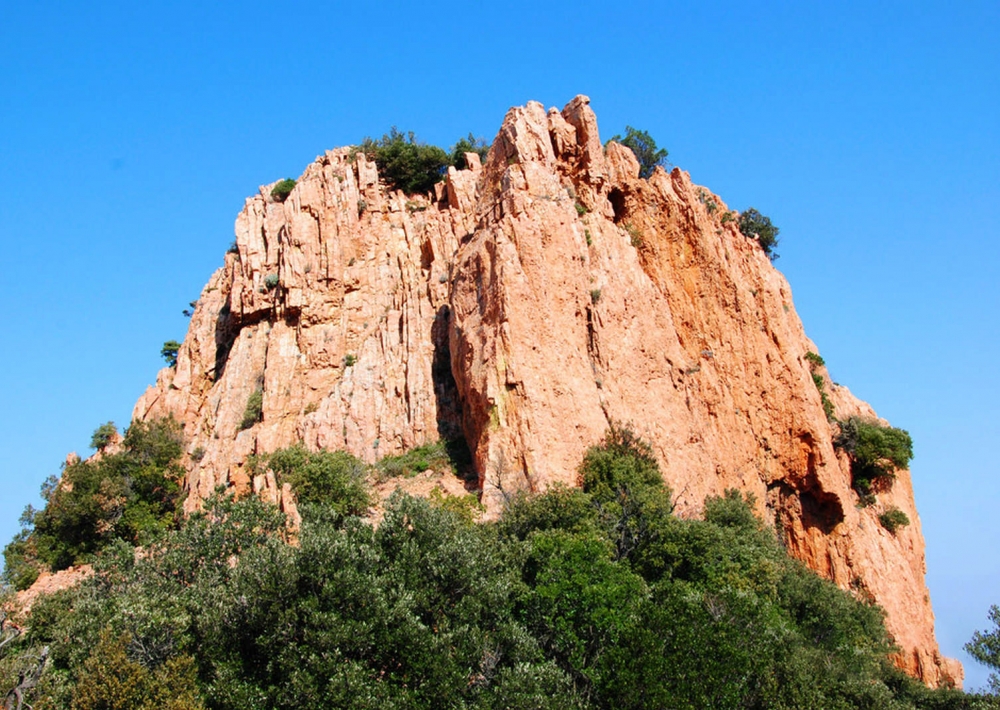
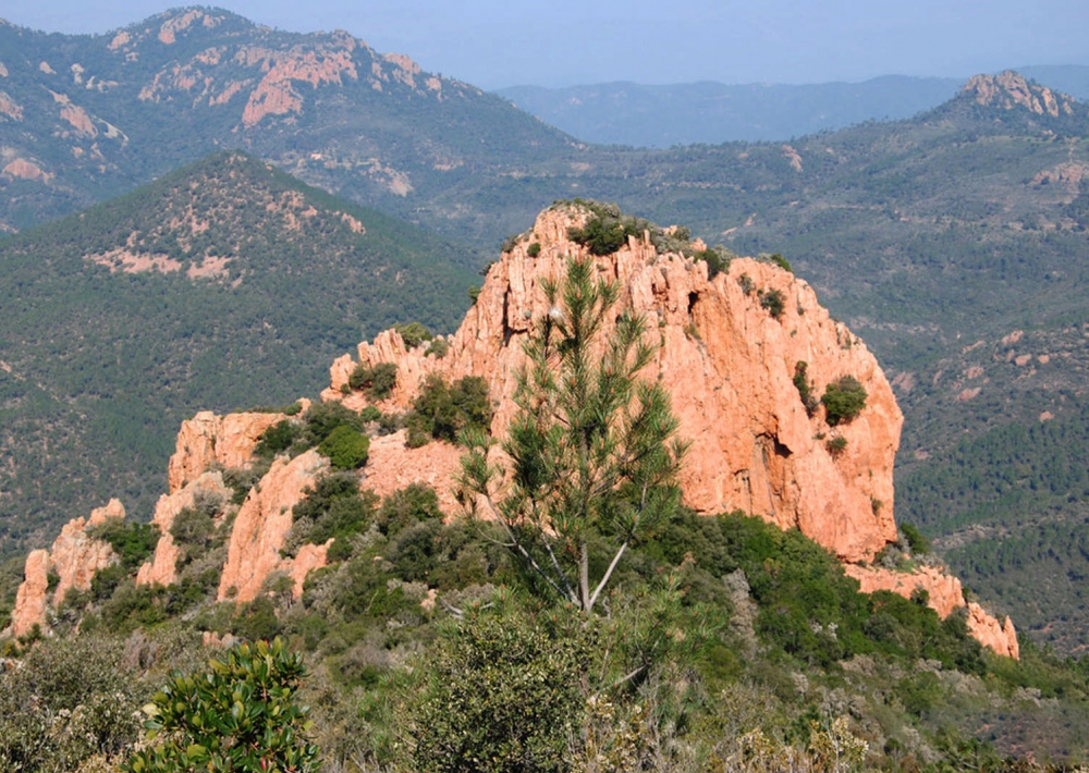
Suivre le sentier balisé en jaune et bleu jusqu’à la Dent de l’Ours. Ce sentier offre de magnifiques vues sur l’Esterel, le Haut Var et le Mercantour.

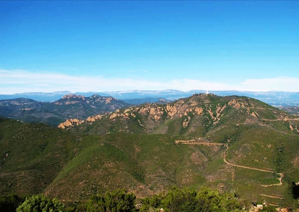
Prendre le temps d’admirer la baie de Cannes et de Saint- Raphaël !

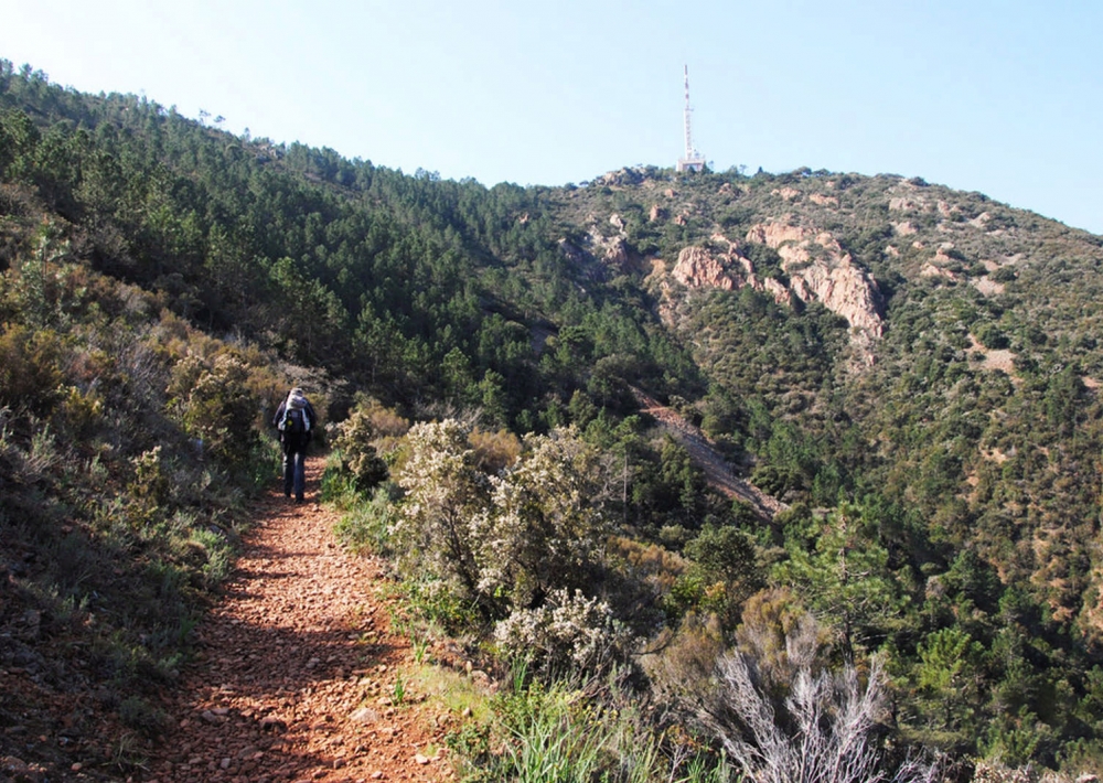
En fin de montée, le sentier rejoint la route d’accès au Pic de l’Ours. Marcher environ 20 mètres sur la route avant d’emprunter le premier sentier à gauche.

Ce sentier assez pentu et parfois pierreux ramène au point de départ. Suivre le
balisage bleu.

Further information

  • flag-FRFrench
  • Type of customers : 
    Level bue - Medium
  • On-site activities : 
    Pedestrian sports
    Hiking itinerary
  • Environments : 
    Mountain location
    Panoramic view
    Sea view
Estérel Côte d'Azur depending on your mood
Weather
Sea side
Today
-- °C Wind : -- km/h
Tomorrow
-- °C Wind : -- km/h
After tomorrow
-- °C Wind : -- km/h
Hinterland
Today
-- °C Wind : -- km/h
Tomorrow
-- °C Wind : -- km/h
After tomorrow
-- °C Wind : -- km/h
Water temperature
Fréjus -- °C
Saint-Raphaël -- °C
Les Issambres -- °C
+
-

Clic on areas to zoom in

Clear map
Dark map
Map zone 1
Map zone 2
Map zone 3
Map zone 4
Map zone 5
Map zone 7
Map zone 6
Map zone 8
pays de fayence - nord

Fayence area

The Pays de Fayence (Fayence district) has many great provencal villages. All of them have a particularity such as the view from Mons or the artistic streets of Tourrettes. Do no forget to stop in Seillans that has the label of "Most beautiful village in France"

Go back to map
pays de fayence - sud

Fayence area

North of the A8 motorway, you will find the Pays de Fayence. Saint-Cassien lake, a real oasis of freshness in the Var, awaits you! Take a break at the Lake House before visiting the villages of Bagnols-en-Forêt, St-Paul-en-Forêt or Tanneron.

Go back to map
roquebrune sur argens - la bouverie

Roquebrune-sur-Argens

The city of Roquebrune-sur-Argens is the most westerly of the destination. It includes three districts: La Bouverie, at the foot of Gorges du Blavet; The village, overlooked by its magnificent rock, and Les Issambres, with its nautical activities by the sea.

Go back to map
les adrets de l'esterel

Les Adrets de l'Estérel

Les Adrets de l'Estérel is a small town located at the extreme southeastern Var. Bordering the Maritimes Alpes, it is composed of large green forests. The town overlooks the bay of Cannes and has an exceptional view on the Lérins Islands and the Corniche de l'Estérel.

Go back to map
village de puget sur argens

Puget sur Argens

Puget sur Argens is a small village located in the middle of many wineries. Its commercial area, near the village, includes many shopping center. North of the village, the Bois du Defens give rise to several walks.

Go back to map
roquebrune-sur-argens - les issambres

Les Issambres

Welcome to Les Issambres, the district of Roquebrune-sur-Argens located on the coast. True paradise with its 8 km of beaches and creeks, this family seaside resort, already frequented at the time by the Romans, is located between the Gulf of Saint-Tropez and Fréjus-Saint Raphaël.

Go back to map
ville de frejus - saint-aygulf

Fréjus

Frejus, located halfway between Cannes and Saint-Tropez, is at the heart of the Côte d'Azur. Based on a sandstone buttress of the Esterel massif, the town dominates the valleys of Argens and Reyran. Frejus has the appearance of a small Provencal town whose new districts extend to the sea.

Go back to map
saint-raphael - massif de l'esterel

Saint-Raphaël

65km from Nice Côte d'Azur International Airport, Saint-Raphaël is located between Cannes and Saint-Tropez. This seaside resort on the Mediterranean coast is at the bottom of the great Esterel mountains. Saint Raphael, whose city center is by the sea, is divided into different neighborhoods that have all their characteristics and their personalities.

Go back to map
Fayence areaFayence areaRoquebrune-sur-ArgensLes Adrets de l'EstérelPuget sur ArgensLes IssambresFréjusSaint-Raphaël
Webcams
Subscribe to our newsletter